WillyLogan.com

Technology, History, and Place

Page 2 of 44

The ugly rivers of Southern California

Recently, I was down in Southern California to do some research in the Water Resources Collection & Archives at UC–Riverside. On the way back north, I stopped in Montebello, east of Los Angeles, to visit the site of one of the last battles of the Mexican-American War in California, the Battle of Río San Gabriel. On the afternoon of January 8, 1847, Californio forces under the command of José María Flores tried to prevent American troops from crossing the San Gabriel River as they headed toward Los Angeles. Having read about the battle beforehand, I was able to picture the site in my head: a wide, shallow river, with a sandy bottom, bordered by willows on either side.
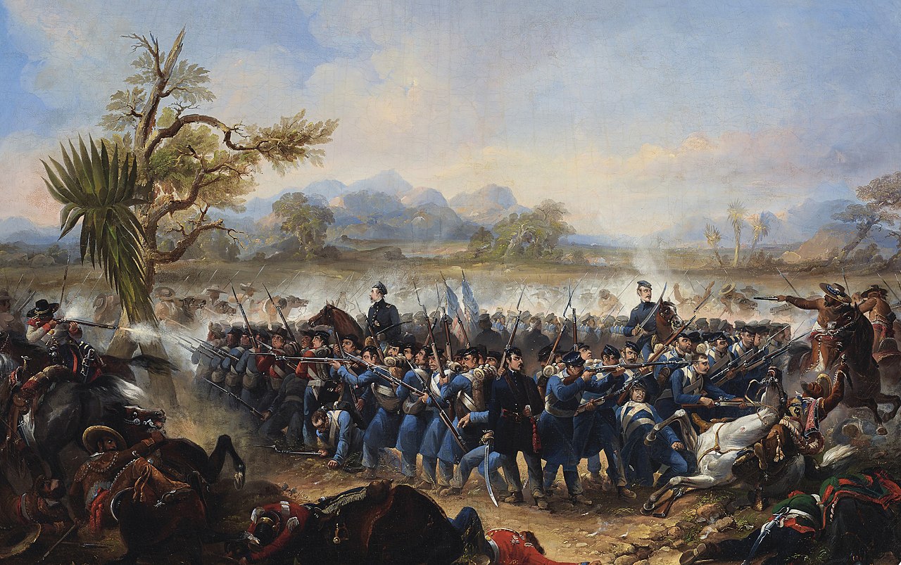
Painting of the Battle of Río San Gabriel by James Walker. The description of the picture identifies it as the Battle of Los Angeles, which was a different battle the next day (also known as the Battle of the Mesa). But I’m almos certain that this actually portrays the Battle of Río San Gabriel, because it matches the accounts of the battle, and doesn’t match the Battle of Los Angeles, which was a running engagement. (Source: Wikimedia Commons.)

Painting of the Battle of Río San Gabriel by James Walker. The description of the picture identifies it as the Battle of Los Angeles, which was a different battle the next day (also known as the Battle of the Mesa). But I’m almos certain that this actually portrays the Battle of Río San Gabriel, because it matches the accounts of the battle, and doesn’t match the Battle of Los Angeles, which was a running engagement. (Source: Wikimedia Commons.)

What I saw instead was very different: a massive concrete channel, littered with trash but without so much as a trickle of water flowing in it or a blade of grass growing along its length as far as the eye could see.
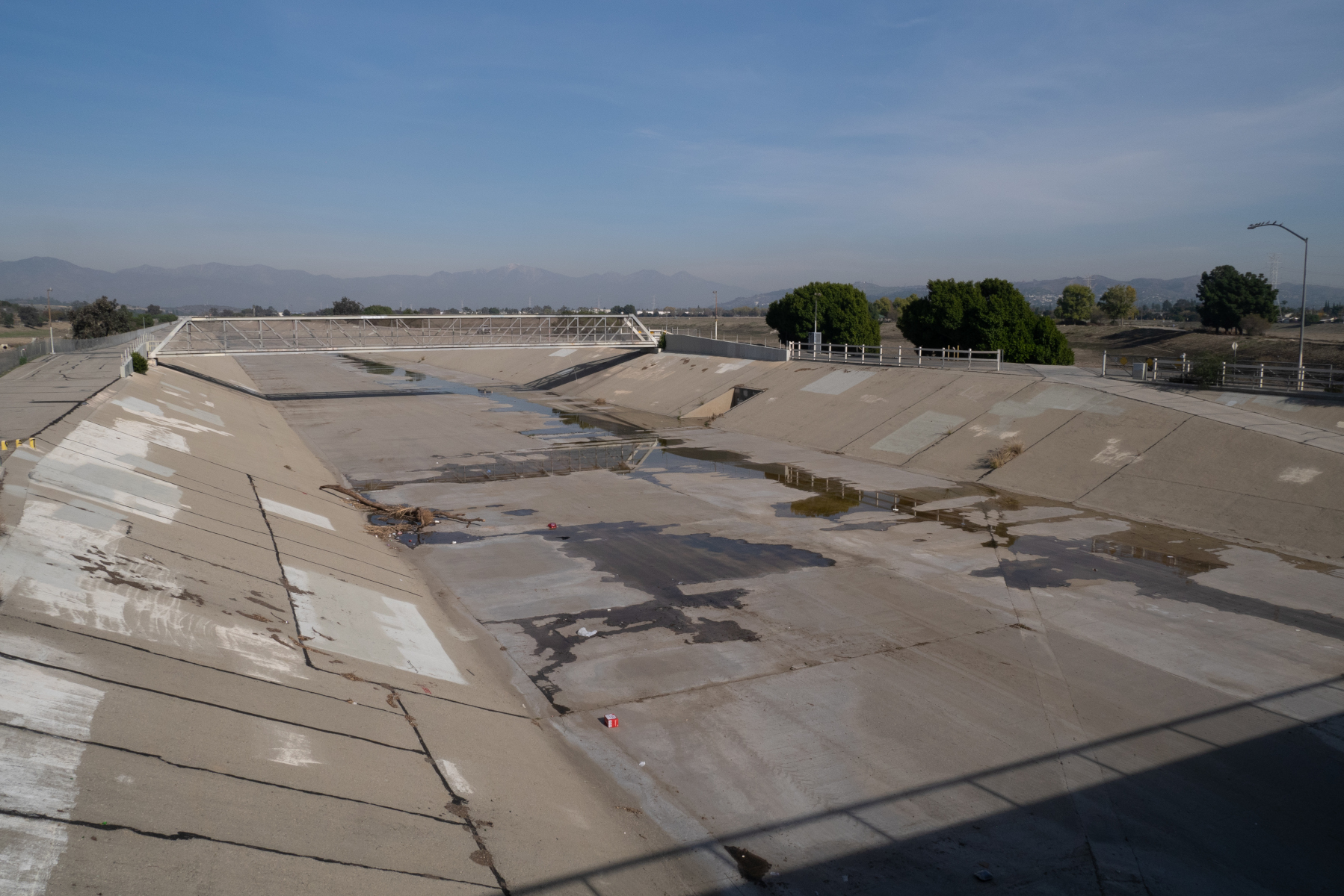
What the Battle of Río San Gabriel site looks like now. (Note that this is actually the Río Hondo rather than the San Gabriel River; see below.)

What the Battle of Río San Gabriel site looks like now. (Note that this is actually the Río Hondo rather than the San Gabriel River; see below.)

I was surprised by what I saw, but I shouldn’t have been. Come to think of it, all of the rivers I had seen in the greater Los Angeles area were heavily engineered. The river in Montebello was a twin of the more-famous Los Angeles River (and in fact is a tributary of it). The Los Angeles River borders the downtown area and has hosted chase scenes in various movies (including Terminator 2). Looking down at the engineered river channel in Montebello, I couldn’t help but wonder:

Why are the rivers of Southern California so ugly?

When I got home, I found the answer in a book in my library. The book was The Los Angeles River: Its Life, Death, and Possible Rebirth, by Blake Gumprecht. According to the book, the flow of the Los Angeles River varied widely between the seasons. During the dry summer months, the river would be a lazy, languid stream, meandering this way and that as it flowed down from the mountains to the sea near Long Beach. But in rainy winters, the river could become a raging torrent, washing away houses, farms, animals, and people.

Los Angeles proper was not vulnerable to flooding so much as the towns up- and down-stream of the city. As the Southland developed, and buildings and pavement took over land that used to absorb rainfall, the problem of flooding got to be more acute. Attempts to deal with the problem at the local level had limited success. Then the Depression came, and the federal government took over responsibility of flood control on the Los Angeles River. After a devastating flood in 1934, the Army Corps of Engineers began to channelize the Los Angeles River and line it with concrete. (An even more catastrophic flood in 1938 highlighted the need for better flood control measures on the river.) Between 1936 and 1959, the Corps channelized almost the entire length of the Los Angeles River.
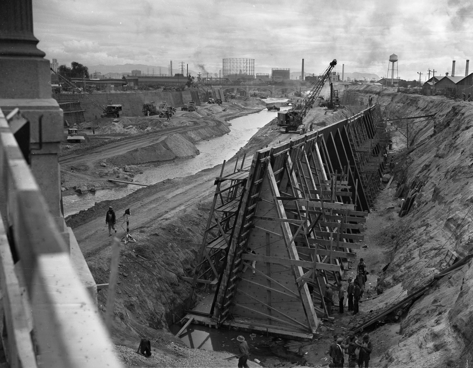
Scene from the construction of the concrete channel of the Los Angeles River, 1938. (Source: UCLA Library Digital Collections, CC BY 4.0)

Scene from the construction of the concrete channel of the Los Angeles River, 1938. (Source: UCLA Library Digital Collections, CC BY 4.0)

What about the site of the Battle of Río San Gabriel? Surprisingly, while the battle took place on the San Gabriel River, the river that flows by the site now is actually the Río Hondo, a completely different river! In 1867, before the flood control measures were built, the San Gabriel shifted its course to the east and the Hondo occupied the old channel of the San Gabriel. Flood control works on the Río Hondo and the modern San Gabriel River were built in the mid-20th century, at the same time as the Los Angeles River. The Army Corps completed the Whittier Narrows Dam on the San Gabriel River and Río Hondo in 1957.

The concrete river channels of the Los Angeles area were (and still are) marvels of engineering, but they are also ugly and obviously predate the modern environmental and beautification movements. Still, it’s hard to imagine Southern California without them, and we seem to be stuck with them for the time being.
soyuz-boosters-setup_banner

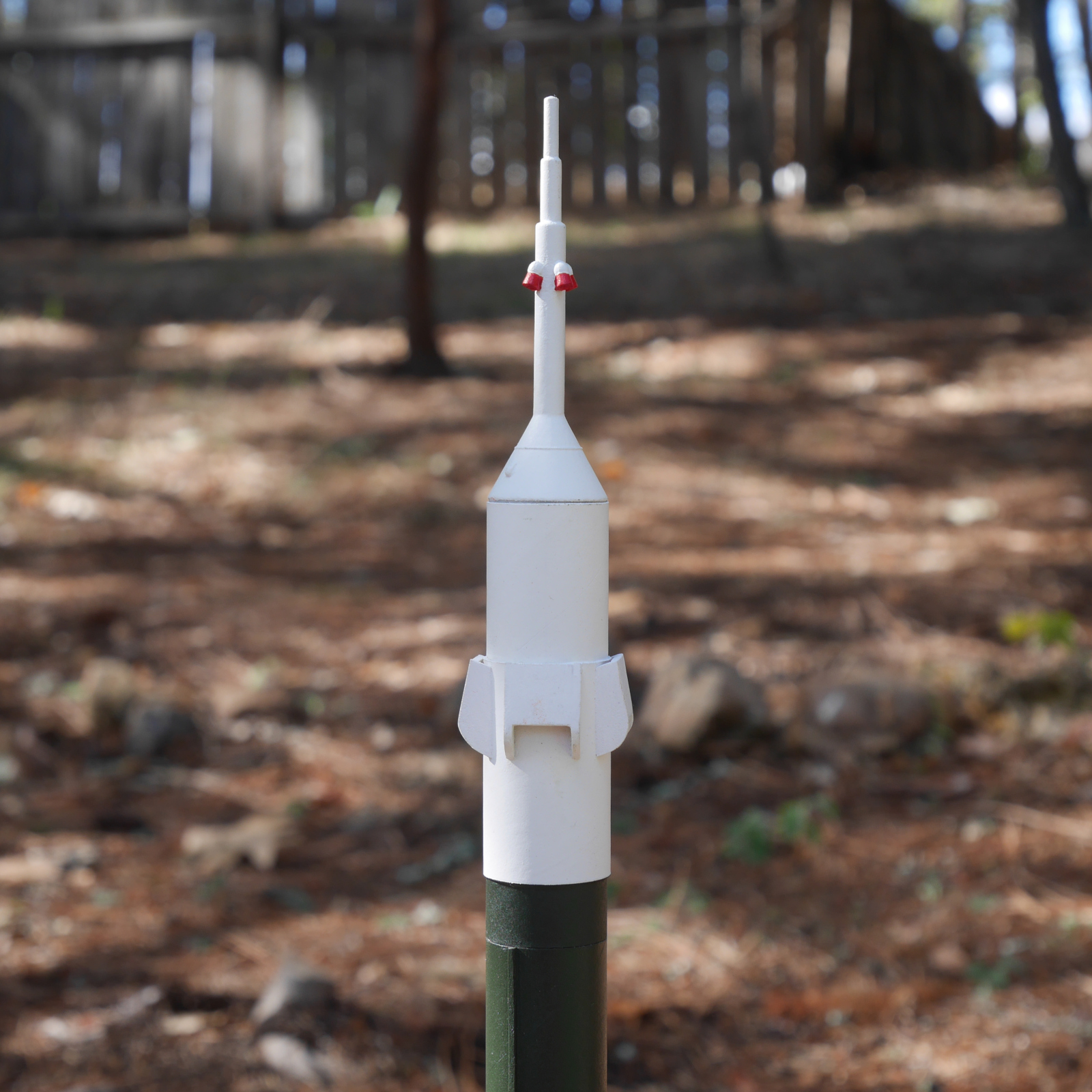
“Simplified Soyuz” model rocket

Two years ago, I watched a Soyuz launch to the International Space Station on NASA TV. I was inspired to write a blog post about how both the Soyuz rocket and spacecraft represent at once technological continuity and change. The basis of the Soyuz rocket is the R-7 Semyorka missile, which first flew in 1957. Space launchers derived from the Semyorka have been launching satellites and spacecraft into orbit since Sputnik 1.

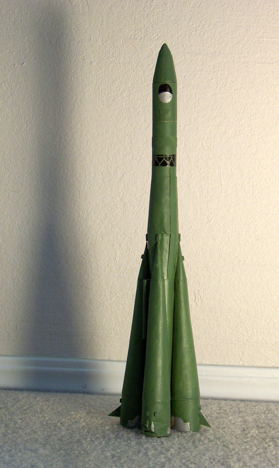
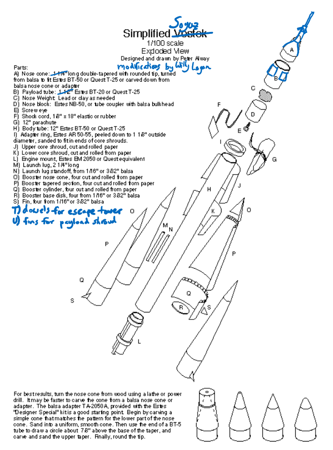
Back when I was in high school, I built and flew a model rocket of another Semyorka-derived space launcher, the Vostok rocket. The model was based on plans by Peter Alway, scale model rocketeer extraordinaire and author of the ever-fascinating (and now apparently back-in-print!) Rockets of the World. Alway had posted the plans on his website (now offline). The geometry of the Semyorka is pretty complex, with lots of tapered cones and tubes of different diameters. Alway simplified the geometry a little and called his plan “Simplified Vostok.”

My own Simplified Vostok was difficult to build, and it took me a couple of years to complete it. The one time I launched the rocket, it had a rough landing, and some of the boosters (made out of paper) got damaged. Years later, I put the rocket on display in my office, with the damaged parts turned toward the wall.

1187-vostok_954px

My “Simplified Vostok” rocket.

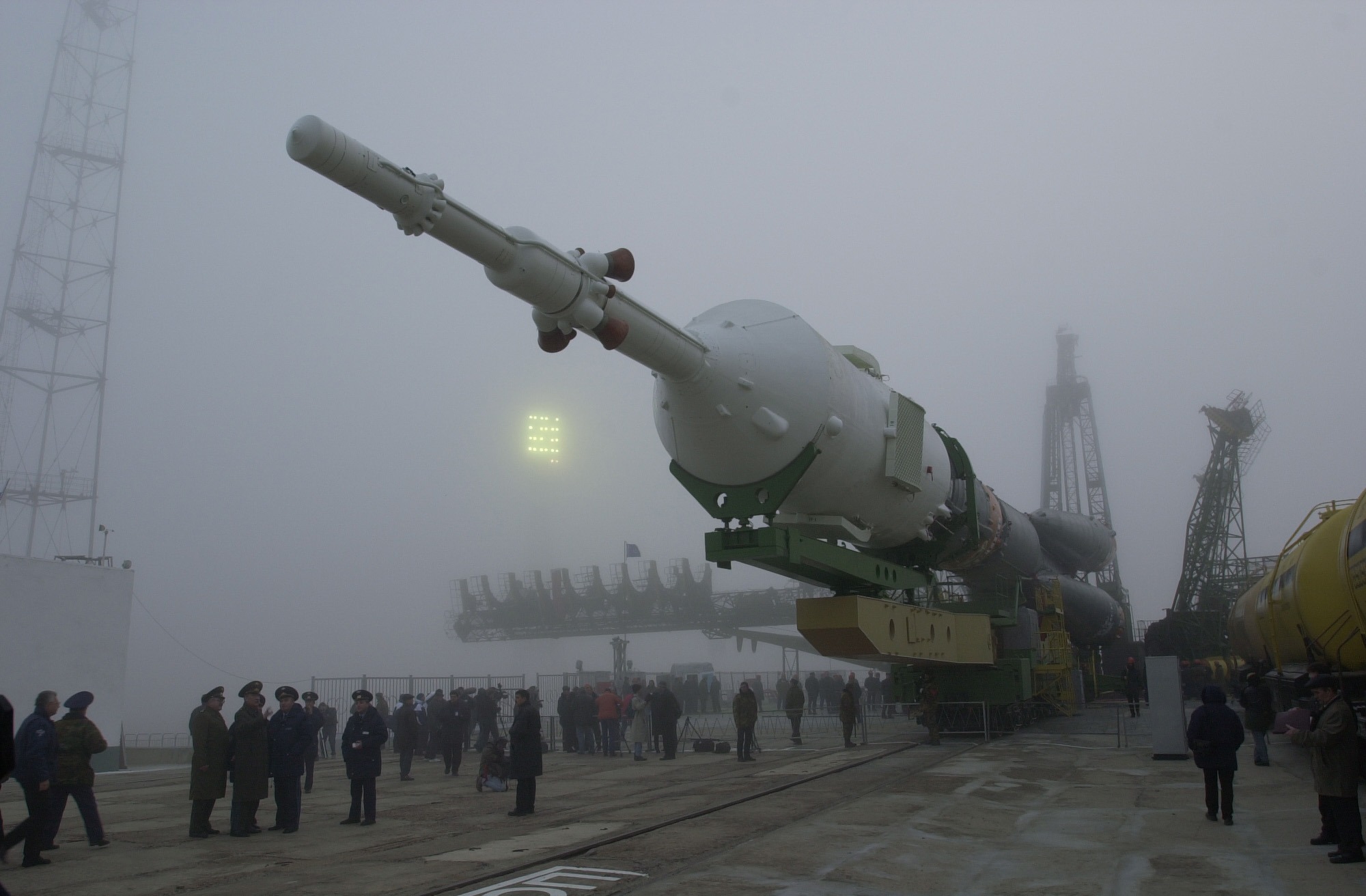
Some time after I watched the 2020 Soyuz launch and wrote the blog post about it, it occurred to me that I could adapt the Simplified Vostok plans to make a Soyuz rocket, or in this case “Simplified Soyuz.” Right around this time, NASA was commemorating the twentieth anniversary of the Expedition 1 mission, the first crew rotation on the International Space Station, which launched on a Soyuz rocket on October 31, 2000. I decided that this would be a good Soyuz launch to portray in my own model.

Expedition 1 (Soyuz TM-31) rocket on its way to the launch pad in Kazakhstan. (NASA photo)

Expedition 1 (Soyuz TM-31) rocket on its way to the launch pad in Kazakhstan. (NASA photo)

Soyuz TM-31 before its erection on the launch pad. (NASA photo)

Soyuz TM-31 before its erection on the launch pad. (NASA photo)

Launch of Soyuz TM-31 on October 31, 2000.

Launch of Soyuz TM-31 on October 31, 2000. (NASA photo)

To convert the Simplified Vostok plans to Simplified Soyuz, I had to lengthen the rocket, as the Soyuz rocket has a larger upper stage than the Vostok rocket did. I also had to redesign the nose cone.

The Soyuz spacecraft has an escape tower, which is used to pull the crew cabin away from the rocket in the event of an emergency. (Mercury and Apollo spacecraft also had escape towers, as does the Orion spacecraft. Vostok had an ejection seat for the lone cosmonaut inside.) Initially, I thought that I would craft the escape tower out of dowels, but I decided instead to try using a new technology that hadn’t been available when I was building rockets twenty years earlier: 3D printing.

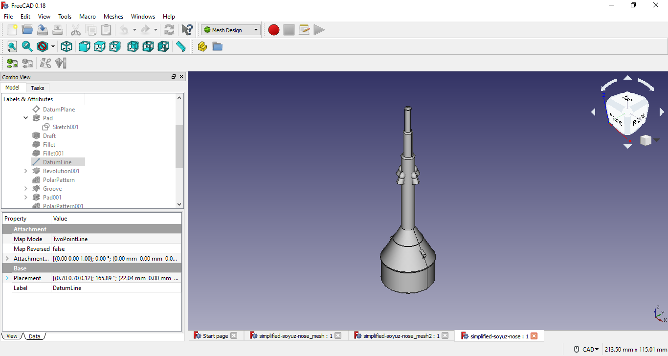
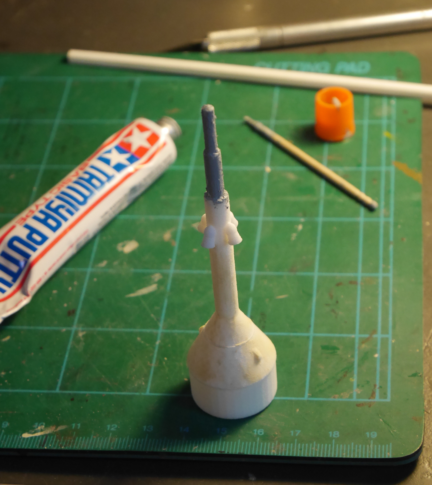
Using FreeCAD, I designed a nose cone with an escape tower, basing it off of data in Rockets of the World. I exported the design to an .stl file and ordered a plastic print of it from Shapeways. I ordered two copies of it, in case I messed one of them up, but this turned out not to be necessary. The printed piece was rough, so I had to putty and sand the surface multiple times until I was satisfied with the result.

Simplified Soyuz plans

Original Simplified Vostok plans by Peter Alway, with my modifications to make it Simplified Soyuz. When I made these modifications, I hadn’t yet decided that the nose would be a 3D-printed part.

Simplified Soyuz nose cone CAD model

Nose cone for Simplified Soyuz, as designed in FreeCAD.

Soyuz nose cone 3D-printed part

Simplified Soyuz nose cone from Shapeways, with its first layers of putty to make the surface smooth.

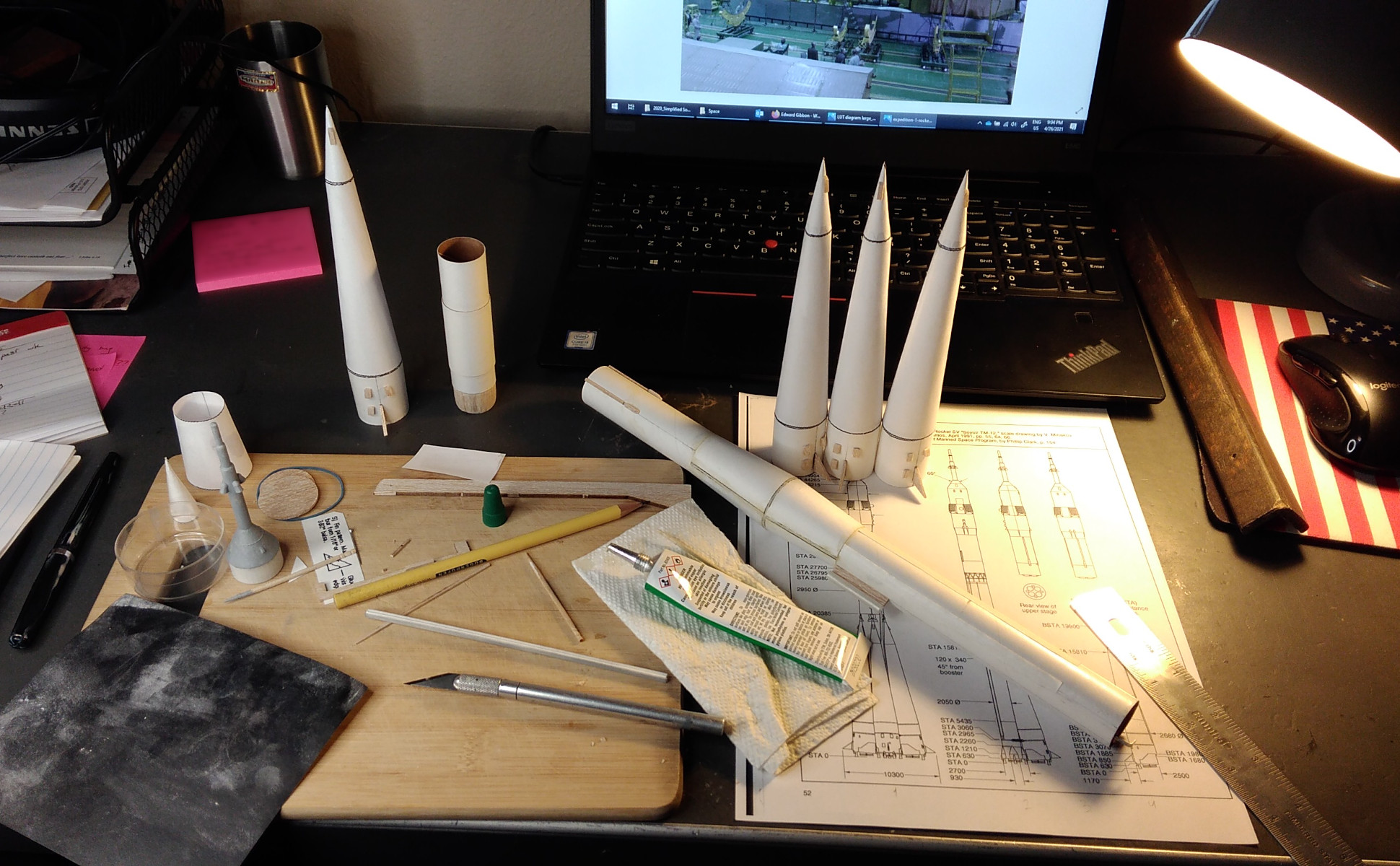
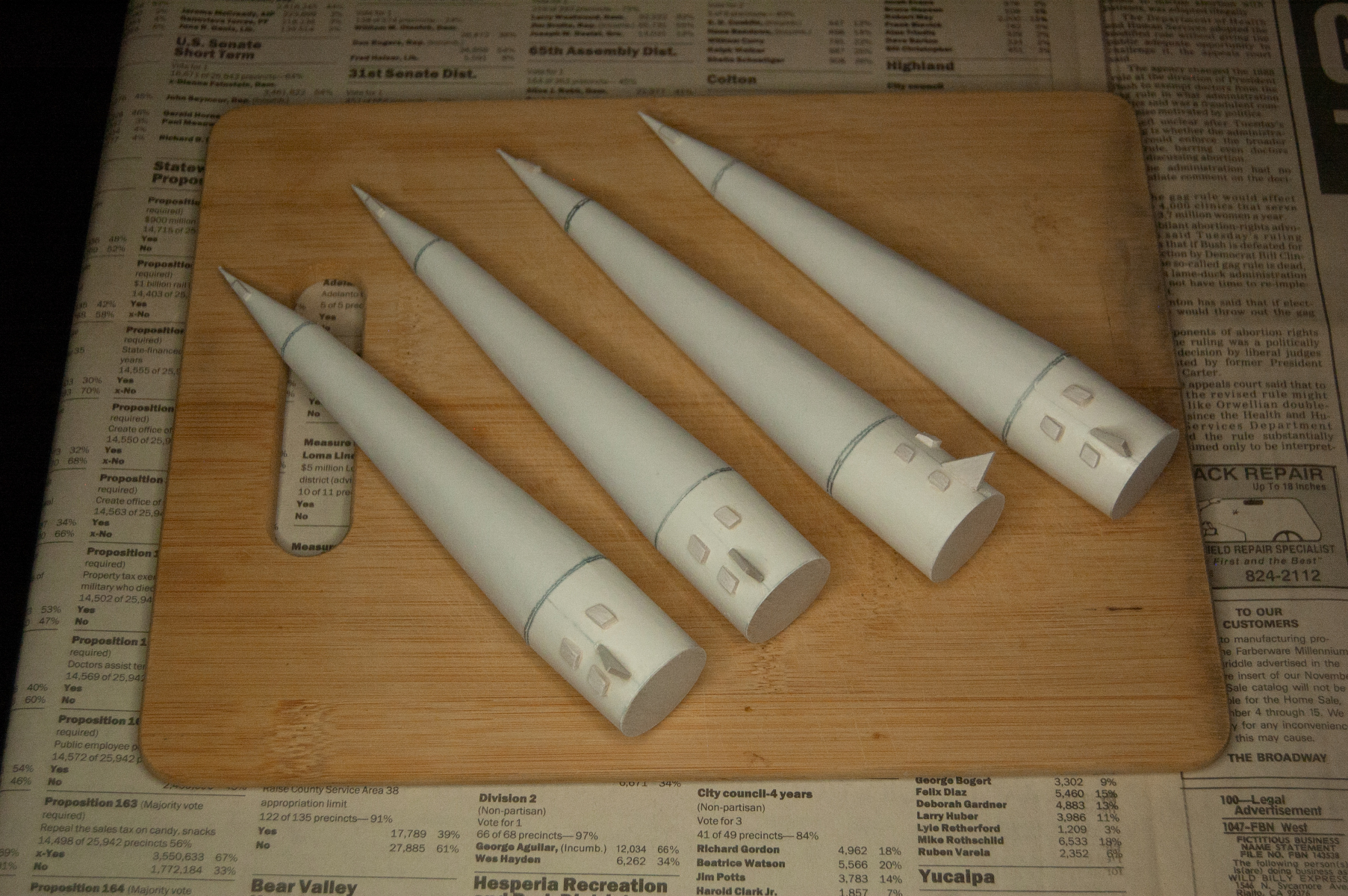
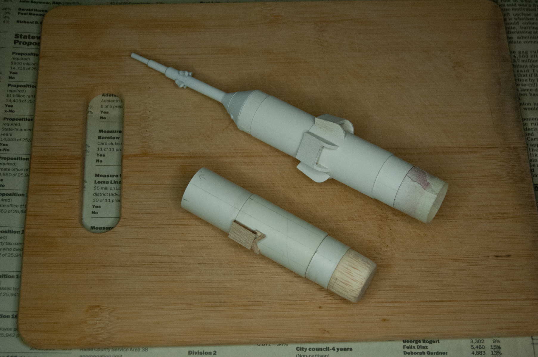
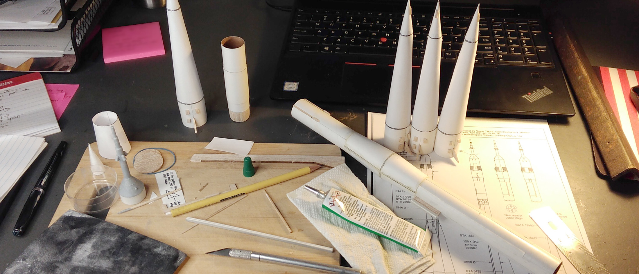
The hardest part of building Simplified Soyuz was assembling the paper boosters. Another challenging aspect of this build was adding little details made out of balsa scraps to make the model look more like the real thing. It took me a couple of tries to get the fins of the launch-abort system to look right.

Soyuz booster assembly

Assembling Soyuz boosters.

Paper Soyuz boosters

Completed boosters, all ready to paint.

Spacecraft fairing attempts

Two attempts at making the spacecraft fairing. The one on top is the one I actually used.

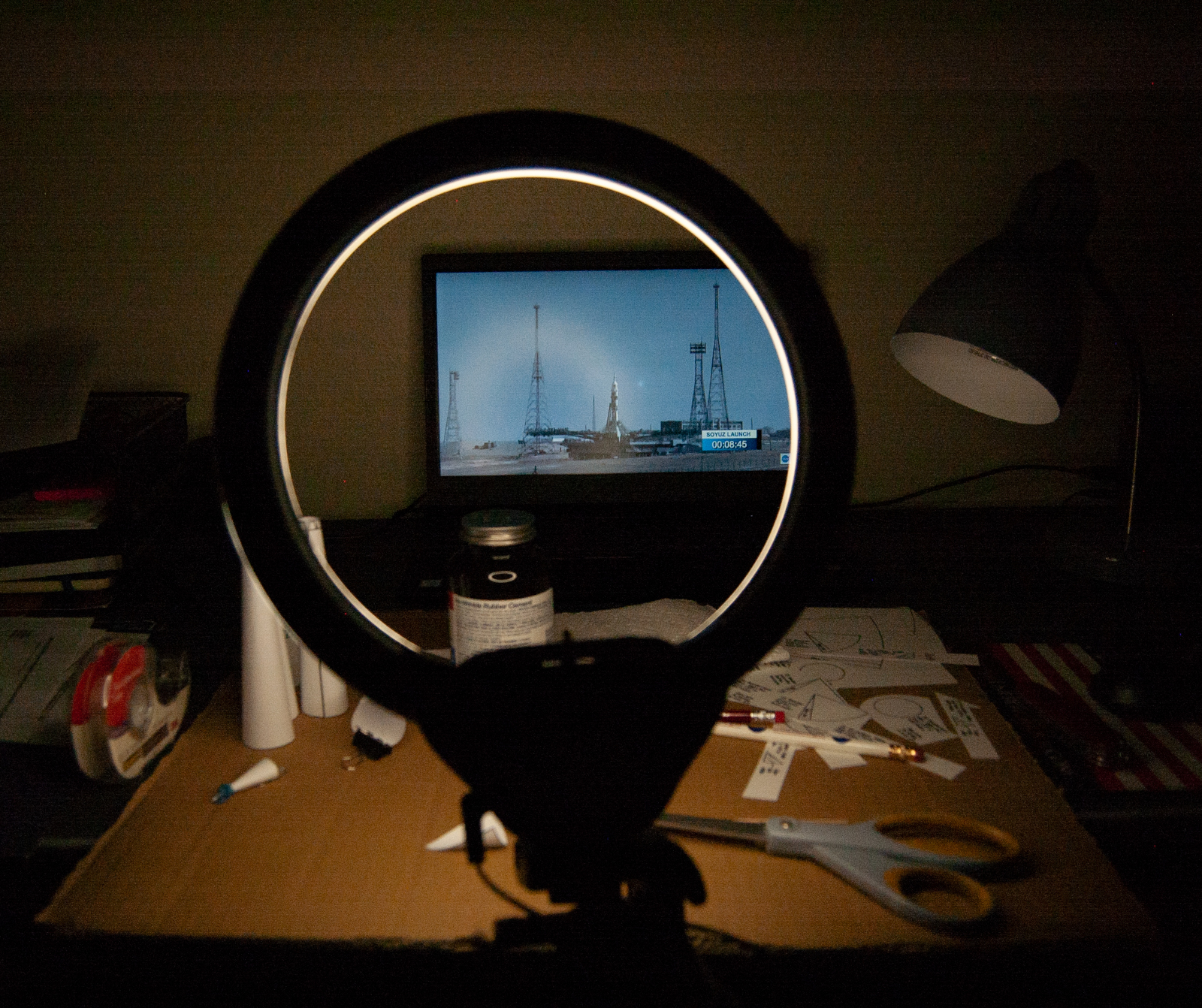
Working on Simplified Soyuz while watching a real Soyuz launch on NASA TV!

Working on Simplified Soyuz while watching a real Soyuz launch on NASA TV!

Painting the rocket was also a big challenge, and it took me more than a year to complete. I did most of the painting with an airbrush, which made for a very smooth finish. The final product looks far better than the Vostok model that I built in high school.

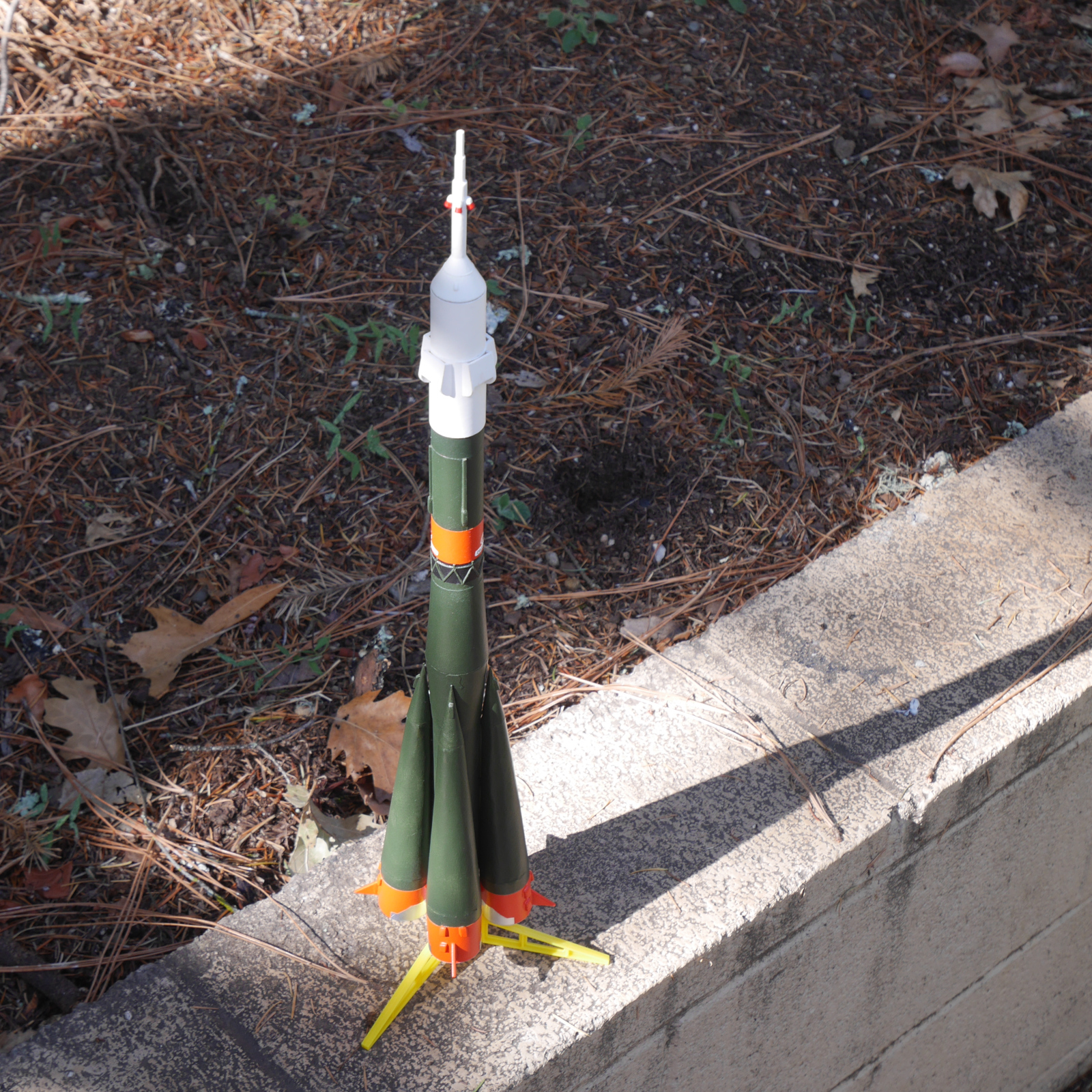
Simplified Soyuz complete

The finished product.

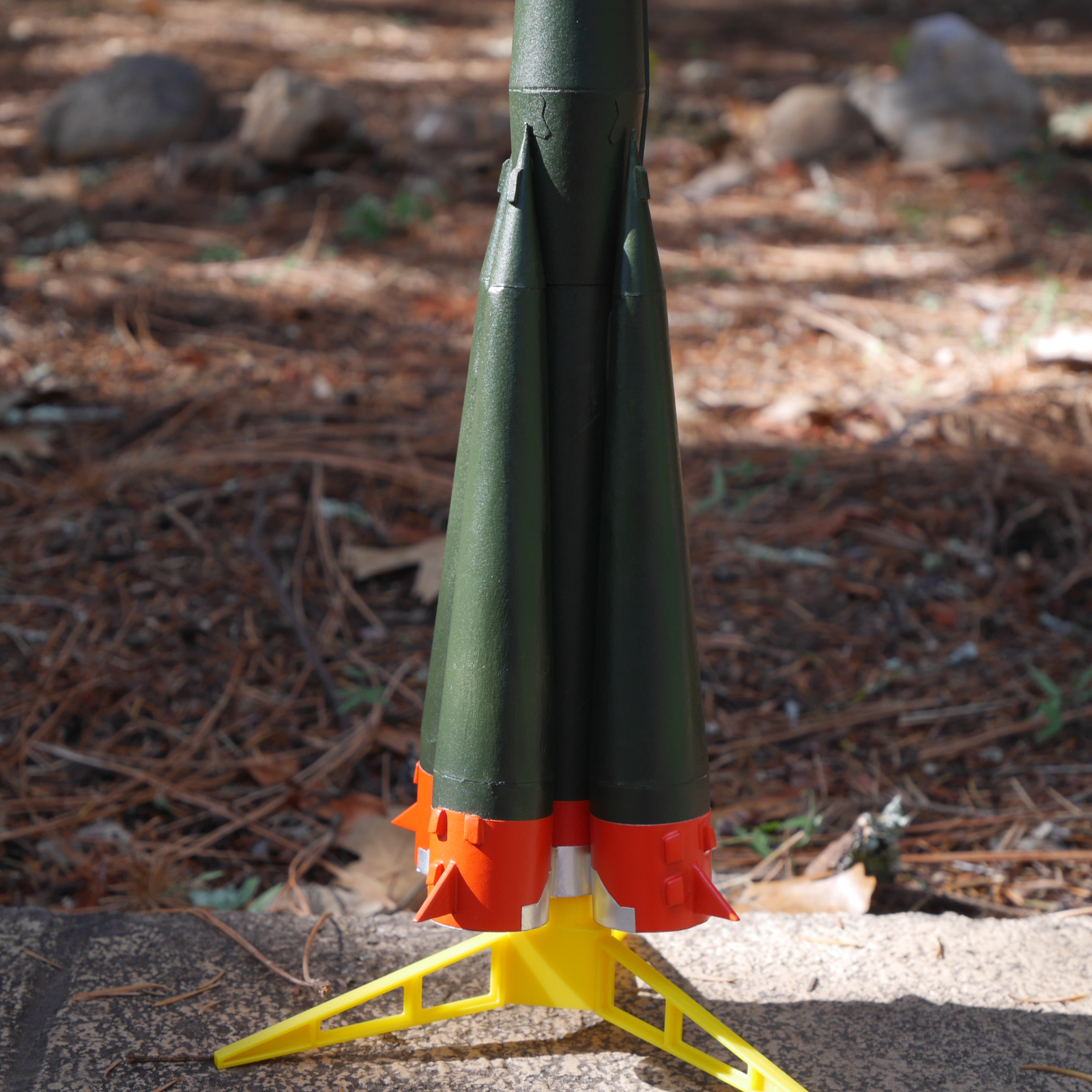
Semyorka boosters

The boosters of the Semyorka.

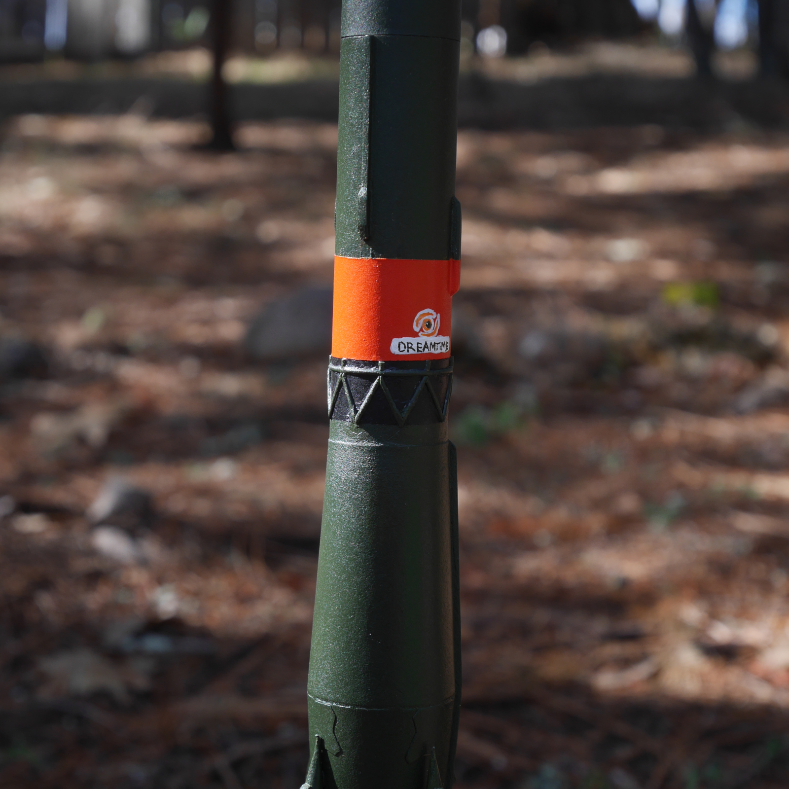
Interstage trusswork

Detail of the interstage between the second and third stages. (This is open trusswork on the real thing. My model only has one stage.)

Spacecraft fairing

Detail of the completed spacecraft fairing.

I built Simplified Soyuz to fly, but I don’t think I will launch it. Thinking back to what happened to Simplified Vostok, I don’t want to risk the same sort of damage to this rocket, at least not any time soon. Maybe later!

Fort Point, guardian of the Golden Gate


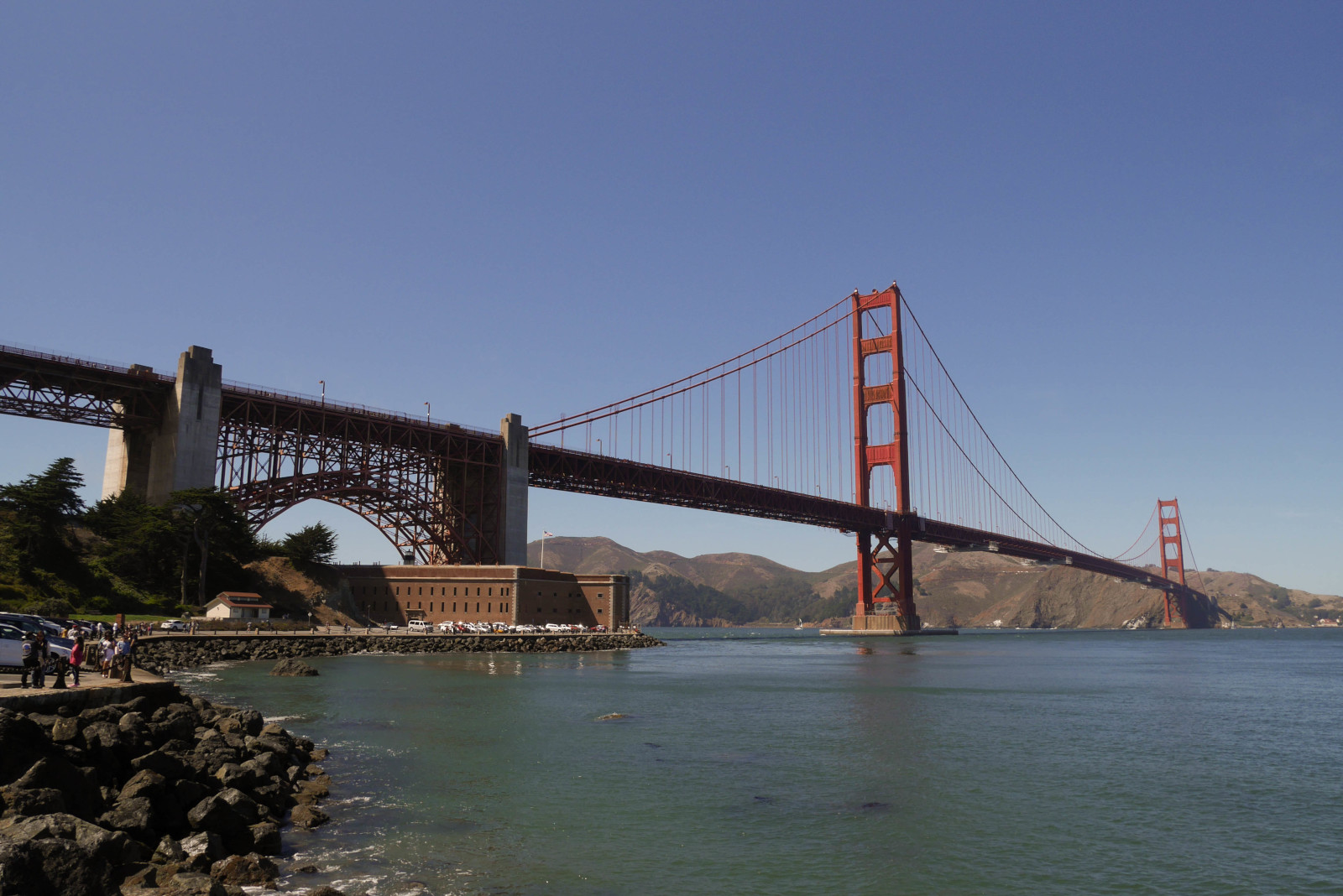
Immediately under the south end of the Golden Gate Bridge stands Fort Point, a US Army fortress that protected the approach to San Francisco Bay during the Civil War. Fort Point is one of the best-preserved coastal defense forts of its era, and one of the few major sites of Civil War significance on the West Coast.

The Army built Fort Point as part of the Third System of Coastal Fortifications, which were built between the end of the War of 1812 and the beginning of the Civil War. Most of the Third System forts were built on the Atlantic and Gulf Coasts. When I lived in Alabama in grad school ten years ago, I visited several Third System forts; some of my pictures of those forts appear in this video.

While I enjoyed visiting those forts, I was disappointed to find that many of them had ugly concrete batteries from a later era, the Endicott System, built right inside them. Not even iconic Fort Sumter, where the Civil War began, was spared this fate! But Fort Point didn’t have any concrete gun batteries built inside it, as there were plenty of more convenient sites for the big guns elsewhere on the Golden Gate (and they probably wouldn’t have fit anyway). Although Fort Point is hardly in pristine condition (all of its original guns are missing, and the fort was modified in an abortive attempt to convert it into a second prison like Alcatraz), the fort is substantially complete, and it is easier to envision how it was used in the 1800s than it is while visiting many other Third System forts.

When researching this video, I found no shortage of secondary source material about Third System forts in general and Fort Point in particular. Some of this material was produced by the National Park Service for its own use in maintaining and interpreting the site. Another very useful source was (surprisingly) a Master’s thesis from the U.S. Army Command and General Staff College at Fort Leavenworth, Kansas, which provided a wide-angle view of Third System forts that other secondary source material lacked.

Fort Point under Golden Gate Bridge

Fort Point is nestled under the southern end of the Golden Gate Bridge. It is easy to miss, but well worth taking the time to pay it a visit if you are in San Francisco.

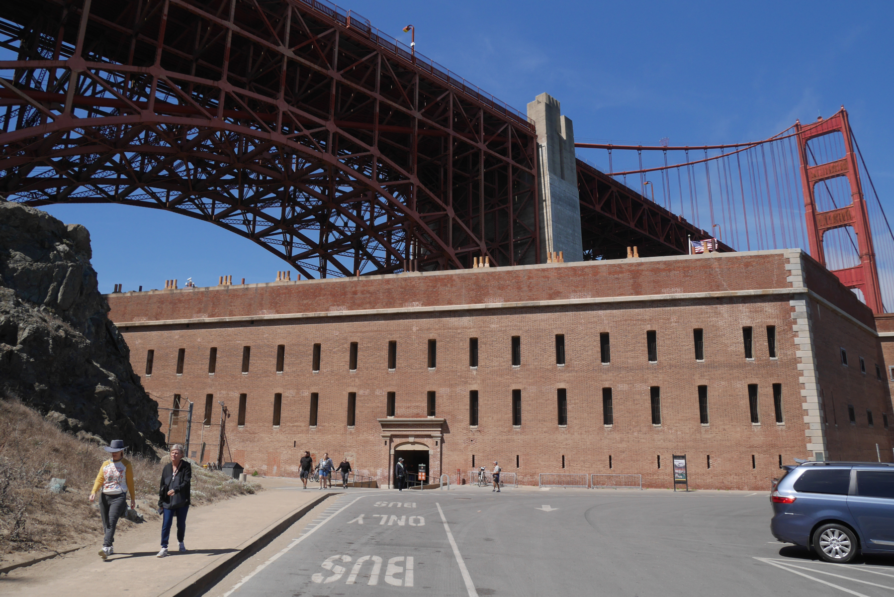
Fort Point scarp wall

The southern or scarp wall of the fort, which was the only wall that did not face the ocean.

Fort Point gorge wall

The gorge wall in the interior of the fort, on the same side as the scarp wall. This is where the officers and enlisted men had their quarters.

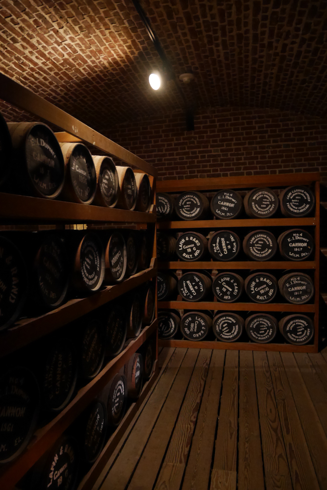
Fort Point powder magazine

The reconstructed powder magazine of Fort Point, in the scarp side of the fort. (This display was under renovation when I shot this video, which is why it does not appear in the video. I took this picture in 2019.)

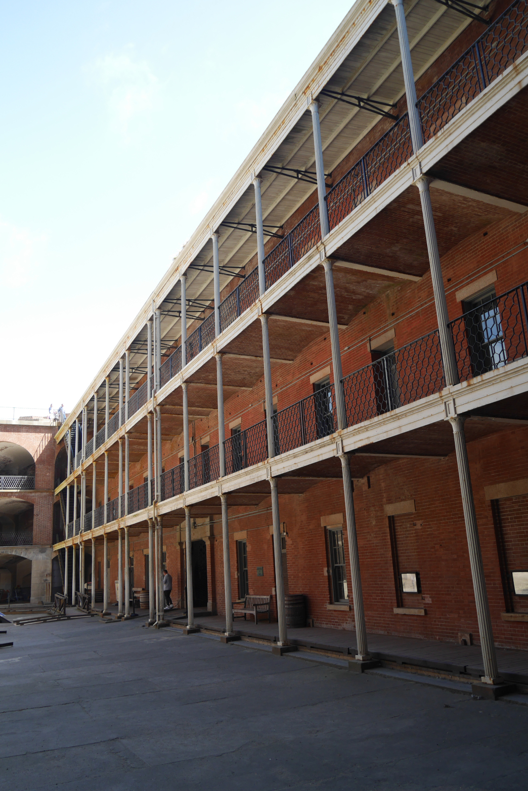
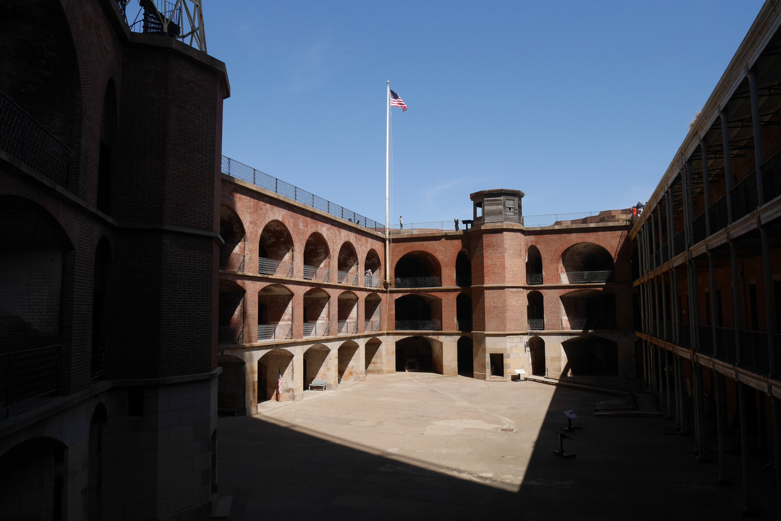
View of the parade ground inside Fort Point. The three arched tiers around the courtyard are the casemates, where the guns were mounted to protect against enemy ships.

View of the parade ground inside Fort Point. The three arched tiers around the courtyard are the casemates, where the guns were mounted to protect against enemy ships.

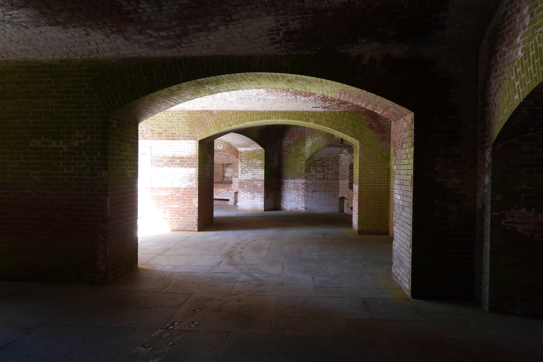
Fort Point vaults

The vaults in the casemates.

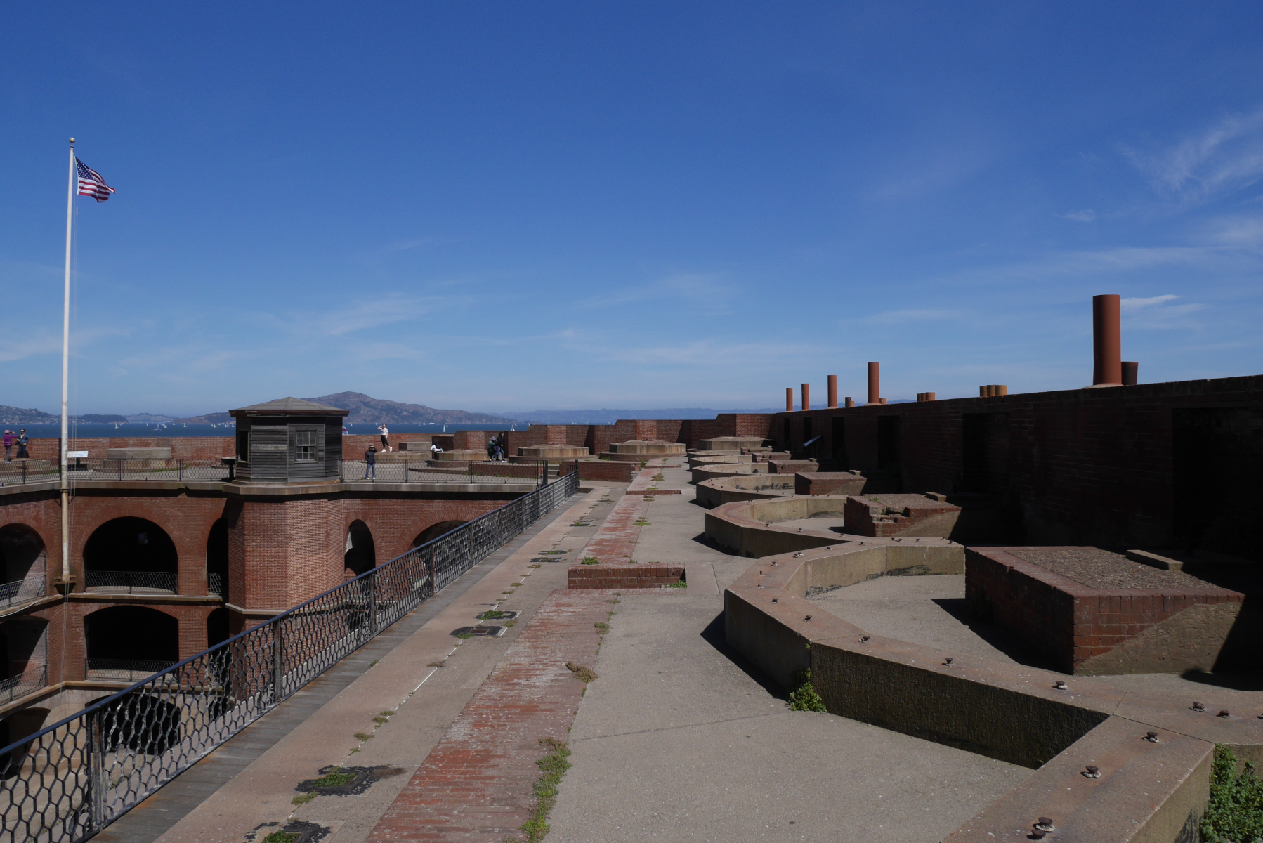
Fort Point roof

View from the top level of the fort.

Sources

  • Charlesworth, Timothy J. “Defending America’s Shore: A Historical Analysis of the Development of the U.S. Army’s Fortification System, 1812-1950.” Master’s thesis, U.S. Army Command and General Staff College, 2000. https://apps.dtic.mil/sti/pdfs/ADA384106.pdf.
  • Cultural Resources and Museum Management Division. Abbreviated Fort Point Historic Structure Report. San Francisco: Golden Gate National Recreation Area, 2006.
  • National Park Service. Fort Point. N.p.: Government Printing Office, 2017.
  • Smith, Mark A. Engineering Security: The Corps of Engineers and the Third System Defense Policy, 1815-1861. Tuscaloosa: University of Alabama Press, 2009.
  • Stephenson, John. “Deterrence in Stone: Seacoast Fortresses of the 19th Century.” Periodical: Journal of America’s Military Past 20, no. 2 (summer 1993): 10-18.

Page 2 of 44

Powered by WordPress & Theme by Anders Norén