WillyLogan.com

Technology, History, and Place

Page 24 of 26

Nepal Himalaya, 2009

The Cold War at 8,848 meters

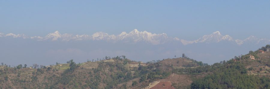
The summits of the tallest mountains in the world, all of which are located in the great Himalayan range from northeastern India to Pakistan, remained inviolate until the 1950s and early sixties, when all of them were climbed for the first time. In 1950, Annapurna in central Nepal became the first peak higher than 8,000 meters to be climbed (there are fourteen in all) when a French team reached the summit. Next, in 1953, a British expedition reached the top of the highest of them all, Mt. Everest or Chomolungma.1

It was by an accident of timing and geopolitics that these great mountains were first climbed in the fifties and sixties. Major European and American expeditions had made attempts on several of the 8,000-meter peaks in the twenties and thirties, but then the outbreak of World War II put these expeditions to a halt. When they resumed after the war, the Cold War had begun, and the subsequent mountaineering conquests took place in the context of this global struggle of ideologies.

In 1960, the Chinese government launched an expedition on the north side of Mt. Everest, which stands in Tibet. This was the first expedition on the Tibetan side since China had annexed the country in 1950. The government reported that three climbers reached the top of the mountain and left a plaster bust of Chairman Mao there as a memento of their visit. Mountaineers in the West generally doubted that the Chinese party had actually made it to the summit, as the only accounts released were party propaganda with a little mountaineering on the side. (The Chinese summiting is more widely accepted as veritable now.) Whether or not the Chinese climbers really reached the top, the expedition was a geopolitical coup, an assertion of China’s sovereignty over Tibet.

Three years later, a very different expedition attacked Everest from the southern side, through Nepal. This was the American Mount Everest Expedition 1963, or AMEE for short. Well-equipped, well-staffed (with 20 expedition members, 37 high-altitude Sherpas, and 909 porters), and well-funded by donations and government grants, the expedition was also highly-publicized. The expedition leader, Norman Dyhrenfurth, was a cinematographer by trade; he produced a movie about the climb and got Orson Welles to narrate it. One of the six members of the team to reach the summit was National Geographic Society photograph Barry Bishop. The expedition even had its own chronicler, mountaineer-author James Ramsey Ullman, who wrote a piece for Life magazine, the script of Dyhrenfurth’s movie, and a full book, Americans on Everest (which is a good read).

In his official account, Ullman repeatedly emphasized that AMEE’s climbing of Everest was not a nationalistic endeavor. For example, this passage:

The Chinese, on their climb of three years before, had declared that “we thought of Comrade Mao, took strength, and moved onward and upward”; but such sentiment would not do for AMEE. With due respect to our Chief Executive, and due allowance for the politics of the various team members, it is highly doubtful if anyone was climbing Everest for the President of the United States.2

Yet even if the men who actually climbed the mountain did not do so for national glory, the expedition had to present itself in a national context in order to get funding. The American public and government asked: Why climb Mt. Everest? It has already been climbed. To which AMEE replied: Because it has never been climbed by Americans before.

The rhetoric convinced individuals, mountaineering clubs, companies, and the US government to donate $400,000 to the expedition. The State Department funded expedition costs in Nepal with a grant of $82,000 in Indian rupees, which the US government had earned from the sale of American wheat and other agricultural commodities to India under the PL-480 Food for Peace program. The State Department also funded a goodwill tour of selected expedition Sherpas around the United States after the climb.

A great, friendly American expedition to Asia aligned well with then-President John F. Kennedy’s internationalist agenda, which also produced the Peace Corps and USAID. When Kennedy presented the National Geographic Society’s Hubbard Medal to the expedition after the successful climb, he emphasized the international character of Himalayan mountaineering, citing other nations that had preceded the Americans to Everest. But he omitted the Chinese, as China was on the wrong side of the Iron Curtain and this was the Cold War after all.

Nawang Gombu presents a kata scarf to President Kennedy at the ceremony for the presentation of the National Geographic Society Hubbard Medal to members of the American Mount Everest Expedition. (Source: Abbie Rowe, White House Photographs, John F. Kennedy Presidential Library and Museum.)

Nawang Gombu presents a kata scarf to President Kennedy at the ceremony for the presentation of the National Geographic Society Hubbard Medal to members of the American Mount Everest Expedition. (Source: Abbie Rowe, White House Photographs, John F. Kennedy Presidential Library and Museum.)

  1. The two actual summiters were Edmund Hillary, a New Zealander, and Tenzing Norgay, a Sherpa from Darjeeling. []
  2. James Ramsey Ullman, Americans on Everest: The Official Account of the Ascent Led by Norman G. Dyhrenfurth (New York: J.B. Lippincott, 1964), 237-38. []
Front facade of Teen Murti Bhawan, New Delhi.

A tryst with research

When he served as the first Prime Minister of independent India from 1947 until his death in 1964, Jawaharlal Nehru lived in Teen Murti Bhawan in New Delhi, a palatial residence originally built for the British Commander in Chief of India. Teen Murti Bhawan sits on a large landscaped plot due south of the president’s palace (Rashtrapati Bhawan), formerly the Viceroy’s House. A long circular drive leads from the compound gate to Teen Murti house itself. Behind the house is a formal garden planted with rose bushes. After Nehru’s death, the house was preserved as a memorial to the man and his times, the Nehru Memorial Museum and Library. Schoolchildren flock to the free museum, tramping through the big house’s empty corridors and taking in a show in Hindi or English at the planetarium on the grounds (built after Nehru’s death).

Behind and to the east of the house, tucked in among the trees, is a remarkable research institution, the library of the Nehru Memorial Museum and Library. Housed in a modern concrete building with dark wood paneling on the interior, the Nehru Library has an elite air, fitting for a place established in memory of wealthy, England-educated Nehru. The regular collection of the library is focused on modern India, and the Nehru Library is without a doubt one of the best places in India to study the late colonial and independence periods. In the back of the library, reached by its own stairway, there is also a small reading room for the library’s archival division, which is supposed to hold the world’s largest collection of manuscripts related to modern India.

The lobby of the library sometimes hosts public exhibitions, but the main stacks are only open to serious researchers, who have to apply for a membership and pay a nominal fee. (When I did some research for my dissertation at NMML two years ago, I paid Rs. 300 for a two-month membership. There are also options of a one-week membership for Rs. 100 and six months for Rs. 500.) Getting permission to access the archives requires its own application, with a letter of introduction from the researcher’s home institution and a form from the researcher’s diplomatic mission in India (for international scholars; I used a photocopy of a form I got for the National Archives of India).

The Nehru Library has open stacks, which is a rare treat in specialized research libraries. The archives, of course, are not open, and the holdings can only be accessed by filling out a request slip. Not all of the archival records are accessible even to legitimate scholars. The papers of Jawaharlal Nehru are only open to 1947. Nehru’s papers from his tenure as Prime Minister are off-limits because they are still classified. (The Indian government’s policy for declassification is not transparent. Even though Nehru has been dead for more than fifty years, his papers are kept out of public view because they theoretically still hold state secrets.) But scholars of modern India need not despair, because the papers of many other post-independence leaders are accessible.

When I did my research at NMML, I ran into two challenges that made my work there harder than I expected it to be. The first was just getting there. Teen Murti Bhawan is located in the sprawling neighborhoods of colonial bungalows on the south side of Rajpath in New Delhi, an area that is poorly served by the city’s metro. I rode the 604 or 620 city buses from Sansad Marg (still sometimes called by its English name Parliament Street) to Teen Murti Circle, but the street was frequently blocked by sit-down protests staged by one or another disaffected part of the population. When that happened, the bus would be routed down a different street, and I never did figure out where.

The other challenge was a result of my not understanding how government business works in India. The National Archives of India is closed for only a few holidays every year: Republic Day (January 26), Independence Day (August 15), Gandhi Jayanti (October 2), and the lunar festivals of Holi (February or March) and Diwali (October or November). NMML and most other offices are also closed on India’s many regular gazetted holidays, which are posted online on the official government calendar, but are not posted anywhere in the building itself. This was at least the case two years ago. I kept making the long trek to Teen Murti Bhawan only to find that the library was closed for a religious holiday celebrated by one of the minority communities. One day, the library was dark and empty for Mahavir Jayanti (Jainism), and the next it was closed for Good Friday (Christianity). If I had known to check for gazetted holidays, I could have planned accordingly and used my time better.

These challenges aside, researching at the Nehru Memorial Museum and Library was a rewarding experience. The private papers I read at NMML provided a human counterpoint to the formal, technical documents I found at the National Archives. The landscaped setting of Teen Murti Bhawan was a refreshing place to research. When I needed a break from manuscripts, I could go walking outside. I enjoyed spending a few weeks at the Nehru Memorial Museum and Library while researching my dissertation, and I hope I get the chance to return there for a future project.

Marina Bay panorama.

How does Singapore work?

For several years, I was perplexed by a little place called Singapore. I had never been there myself, but I had read and heard that it is a completely independent city-state on an island in southeast Asia. The more I learned about technology and economics, the more I was baffled by Singapore. How could a single city on an island survive as an independent nation? To function, cities need hinterlands from which to draw resources. But how can a city’s hinterland be in another country?

I was fortunate to get the chance to visit Singapore for a conference earlier this year, the Society for the History of Technology’s annual meeting. Having visited Singapore, and read up on it during and after my visit, I think I have a better understanding of how Singapore can be a viable city-state on an island. Here are some things I’ve learned about how Singapore works.

Land

It is true that Singapore is very small for a country, but it is large for a city-state. At 278 sq mi, it is much larger than the other two independent city-states, Vatican City and Monaco, both of which are smaller than a square mile. Singapore has room not only for urban areas, but also highways, parklands, reservoirs, military bases, and even some farms.

As Singapore’s population grows, land becomes ever more dear—a problem in dense urban areas around the world. One of Singapore’s solutions to the land crunch is buying sand from Indonesia and using it to reclaim land from the ocean. Another solution is particularly heavy-handed urban redevelopment: unilaterally replacing low-density neighborhoods with high-rise apartment blocks. This has created clean, healthy housing for the common man and woman, but it has also given most of Singapore a generic, characterless appearance.

Although Singapore is an island, it is separated from Malaysia (and the Asian mainland) only by the Straits of Johor, which is about as wide as the Hudson River between New Jersey and Manhattan. There are two permanent above-water links between Singapore and Malaysia, the Johor Causeway and the Second Link. The Johor Causeway opened in 1923, was partially destroyed by retreating Allied troops in 1942, then repaired by the Japanese within days of their occupying the island. It has been in use ever since. The Second Link, a longer but less-interesting concrete bridge, opened in 1998.

Scale model of the entire nation of Singapore, in the Singapore City Gallery.

Scale model of the entire nation of Singapore, in the Singapore City Gallery.

Water

Singapore has four sources of clean water, known as the National Taps: 1) rainwater collected in reservoirs, 2) desalinated seawater, 3) three pipelines from Malaysia that cross over to Singapore on the Johor Causeway, and 4) processed wastewater. The last of these, known as the Fourth National Tap or Newater, processes the water through multiple stages of filtration and irradiation. Most of this water is used by industry, but some of it is pumped up into the reservoirs, mixed with rainwater, processed again, and then delivered to the municipal water system. (One of the Newater plants is integrated into a visitor center. Like so much else in Singapore, it is a tourist attraction.)

The drainage of Singapore island has been engineered on a huge scale, to save as much rainwater as possible. Singapore’s planners have gone as far as damming the mouth of Marina Bay, adjacent to the downtown commercial district, to convert it into a freshwater lake.

Tank at the Newater treatment plant with an integrated visitor center.

Tank at the Newater treatment plant with an integrated visitor center.

Marina Barrage, completed in 2008.

Marina Barrage, completed in 2008.

Energy

A highly-industrialized, heavily-urbanized place, Singapore has high energy needs. The island has no petrochemical deposits. Fortunately for Singapore, Malaysia and Indonesia both have an abundance of petrochemicals. Singapore imports crude oil from its neighbors, processes it in refineries, and re-exports the refined products at a profit. The majority of Singapore’s electricity is generated from imported natural gas. I expected to find that Singapore also bought electricity from Malaysia’s electric grid, but it turns out that the opposite is the case: Singapore sells a little electricity back to its neighbor across the straits.

Food

More than 90% of Singapore’s food is imported. Farms on the outskirts of the built-up area produce some eggs, fish, and leafy greens, but almost everything else needs to be imported. The top sources of fruits and vegetables are Malaysia (of course), China, Australia, and the USA.

Despite needing to import everything—or possibly because of this—Singaporeans have developed a strong and distinctive food culture. My favorite experience in Singapore was eating lunch at a hawker center in Chinatown—a food court for inexpensive, tasty street food. I got filled up on a mushroom-noodle dish for S$4.50.

Economy

Singapore has managed to stay independent and continue drawing resources from its hinterland in other countries because of its robust economy.1 Located strategically on the Straits of Melaka, Singapore has been an important free-trade port almost from its founding in 1819. The city-state’s industries include ship repair, electronics, and petroleum refining. Singapore is also a center of international banking, and its airport is a major hub in southeast Asia. Singapore has been able to sell itself as a clean, hassle-free (if generic) Asian travel experience, and tourism is thus a major part of the economy as well.

Singapore is an orderly, well-managed country. It is a demonstration that technocracy can work on a small scale—as long as you are able to banish your messy hinterland to another country.

Ships anchored off Marina Bay, Singapore.

Ships anchored off Marina Bay, Singapore.

  1. Malaysia is also politically invested in Singapore’s independence. Singapore was a part of Malaysia from 1963-1965, but the Malay States expelled Singapore because their leaders feared the ethnic Chinese of Singapore would dominate national politics. []

Page 24 of 26

Powered by WordPress & Theme by Anders Norén