WillyLogan.com

Technology, History, and Place

Page 26 of 44

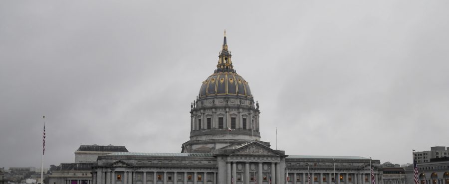
San Fransisco City Hall

How a colony helped found the United Nations

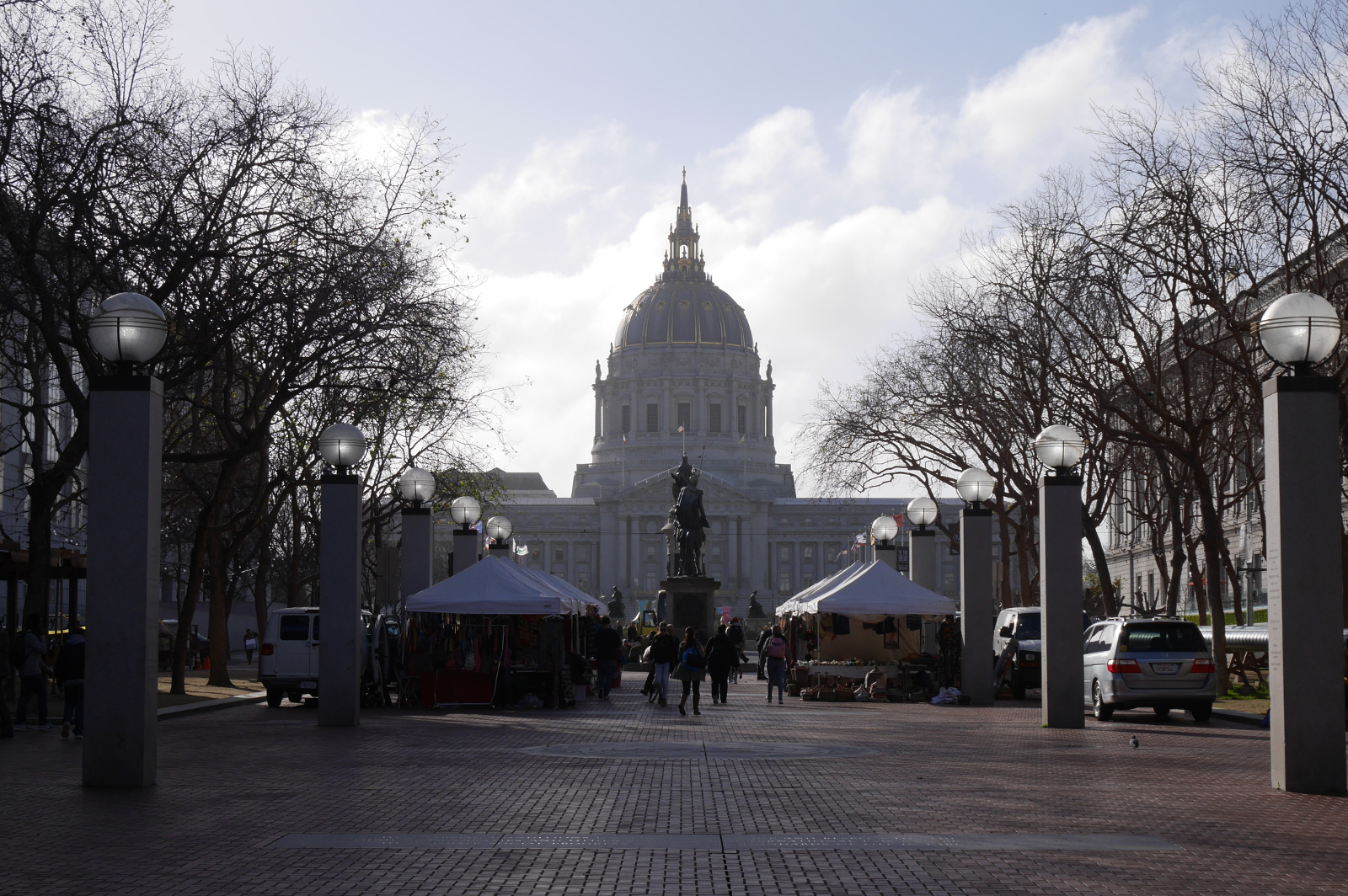
Just to the east of San Francisco’s grand Civic Center, UN Plaza is an unassuming pedestrian mall that hosts farmers’ markets and handicrafts fairs. Were it not for the name of the nearby BART (San Francisco metro) station, Civic Center/UN Plaza, it would be easy to miss UN Plaza among the grander spaces and buildings nearby—Civic Center, City Hall with its gold-trimmed dome, the Asian Art Museum, and the San Francisco Public Library. On either side of UN Plaza, behind the tents of the farmers’ markets, granite pillars are inscribed with the names of all member states of the United Nations, organized by the date of their entry into this global community.

UN Plaza, San Francisco, with City Hall in the background.

UN Plaza, San Francisco, with City Hall in the background.

UN Plaza is located here because it is where the United Nations was founded. With the ratification of the UN Charter in the War Memorial Veterans Building just west of City Hall, the UN came into existence on October 24, 1945 — seventy-two years ago today.

The first pillars in UN Plaza include the names of all fifty-one founding members of the United Nations. The names of the founding members include many names that one would expect to see on the list: Australia, Canada, Denmark, United States, USSR. But there is one name that doesn’t quite seem to fit: India.

How could India have been a founding member of the United Nations in 1945 if wasn’t even its own country yet? India would be a colony of the British Empire for another two years. How could a colony join a community of sovereign states?

The answer lies in the relations forged between India and the United States in World War II.

In March 1941, the US Congress passed the Lend-Lease bill after prolonged debate, enabling the United States to ship supposedly surplus arms to the embattled British Empire, which had been at war with Germany since 1939. At this point, the United States was still officially neutral—and would be until Pearl Harbor nine months later—but the Nazis’ blitzkrieg across Europe had led many American leaders to rethink their traditional stance of isolationism. American industry started to retool for arms production. (Much of the lend-lease aid was actually newly-produced, not surplus.)

As part of the British Empire, India qualified for lend-lease aid. The colony would serve as a staging-ground for the Allied war effort in the China-Burma-India theater. To coordinate aid shipments, the colonial Government of India set up a front office in New York, the India Purchasing Mission, in July 1941. It was the first official, government-to-government link between India and the United States. In 1942, the office was moved to Washington, DC and renamed India Supply Mission (ISM). Throughout the war, ISM coordinated aid from the United States and Canada to India.

When it came time for the United Nations Conference just after the war, India Supply Mission served as the official representative of India in San Francisco. The delegates from ISM would be colonial subjects for a little while longer, but they represented their country in the community of sovereign states.1

India Supply Mission continued to exist after the Indian Embassy was set up in Washington in 1946. After independence, ISM coordinated a different type of aid: development aid. From their office at 2342 Massachusetts Avenue NW, the bureaucrats of India Supply Mission saw to it that their country received the parts, equipment, and loan payments that industrialization demanded.

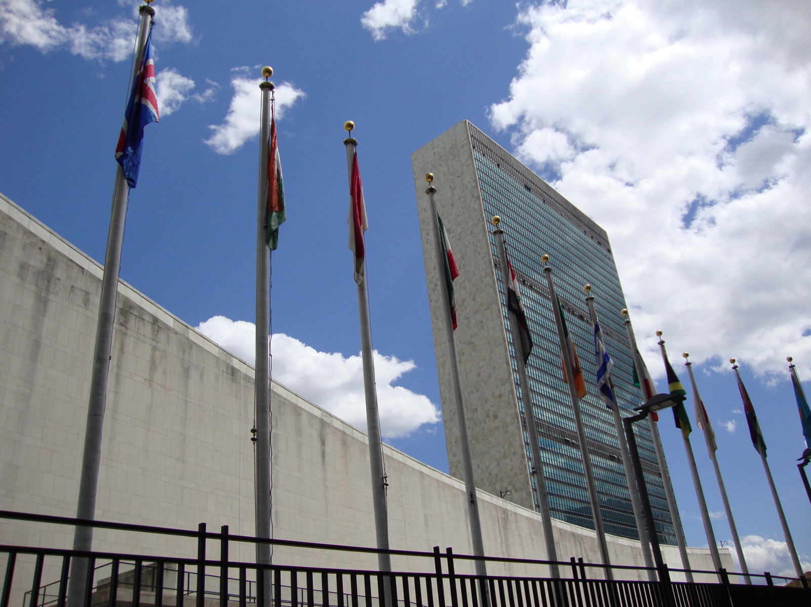
United Nations Secretariat, New York City, with flags of member states in the foreground.

United Nations Secretariat, New York City, with flags of member states in the foreground.

  1. India had earlier signed the “Declaration by the United Nations,” on January 1, 1942. During the war, the name “United Nations” referred to the Allied powers. After the San Francisco conference, the name acquired its modern meaning. []
Brooklyn Bridges pan

Exploring Brooklyn’s battlefield

In 2014, I spent part of the summer in Washington, DC, researching for my dissertation at the National Archives and Library of Congress. On weekends and some afternoons, I explored the city and surrounding region, and I even made longer trips to Pennsylvania and New York. As I traveled around, I kept running across sites or artifacts associated with the American Revolutionary War. The more I saw and read about the Revolution, the more I became aware of how little I knew about that part of history.

I made up my mind to read The Glorious Cause, by Robert Middlekauff, the volume of the Oxford History of the United States about the Revolution. The book is long, so it took me a while (I had to take a lengthy break in the middle), but it was worth reading, because I learned much that I, as a historian of the twentieth century, had never before had occasion to learn. (Since my fateful summer of 2014, interest in the Revolutionary War has gone mainstream, thanks to Lin-Manuel Miranda and Hamilton.)

While reading The Glorious Cause, I was particularly fascinated by Middlekauff’s narrative of the Battle of Long Island, also known as the Battle of Brooklyn—an engagement I had never heard of before. The Battle of Brooklyn (August 26-30, 1776) was the first major military engagement of the American Revolution after the adoption of the Declaration of Independence two months earlier. British troops, under the command of General William Howe, landed on Long Island and attacked the Americans under George Washington. (These events are covered in the Hamilton song “Right-hand Man.”) The American forces were protected behind the hills known as the Heights. The passes nearest the American positions in Brooklyn (then a village independent of Manhattan) were well defended, but the British circumvented the defenses by taking the lightly-defended Jamaica Pass to the east. A contingent of Marylanders died holding the main body of the British troops off at the Vechte farm, but most of the rest of Washington’s army escaped across the East River to Manhattan, surviving to fight another day.

In the 240 years since the battle, Brooklyn has grown to engulf the farmlands and woodlands where British and Continentals clashed. Scattered around the borough are sites associated with the battle, some marked with plaques, others not (but all listed in detail in this comprehensive guide). In addition to gentrified brownstones, hipster lofts, and forbidding project housing, Brooklyn has its own Revolutionary War battlefield. Brooklyn has it all.

In March this year, I spent a day exploring Brooklyn, looking for sites that had to do with the battle or the Revolution in general. I found two sites particularly interesting.

The first was Prospect Park, site of a pass where American troops were routed by Hessian mercenaries fighting on the British side. The park, designed by Frederick Law Olmstead (whose other credits include Central Park in Manhattan and the US Capitol grounds) preserves part of the landscape of the battlefield, which has been lost under buildings and streets most everywhere else in the borough.

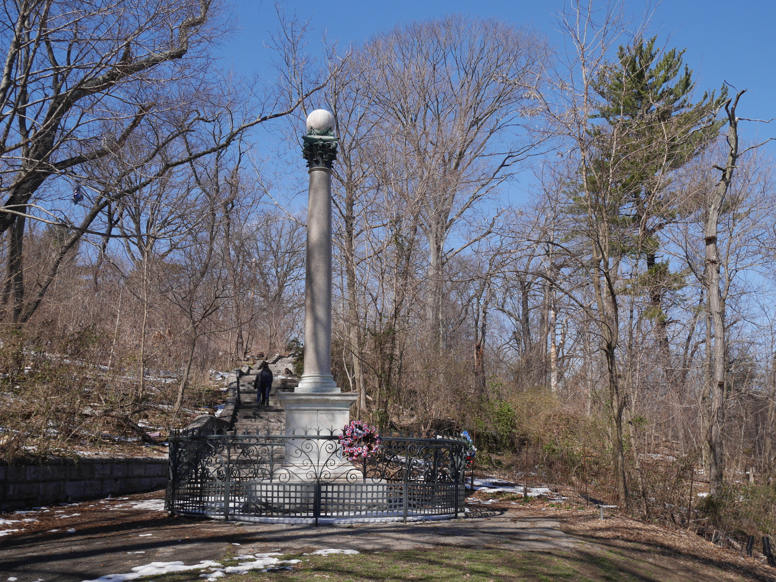
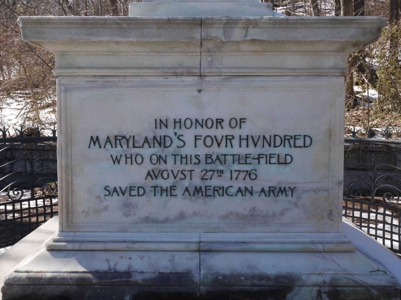
On a hillside in the park stands a monument to “Maryland’s Four Hundred,” who fell holding back the British (or “saved the American army,” in the exaggerated wording of the monument). The mention of the number of Marylanders is a not-so-subtle reference to the Three Hundred Spartans, who held the Persian army off at the Battle of Thermopylae in 480 BC, while the armies of other Greek city-states escaped to regroup and ultimately defeat the Persians. The placement of the monument to 400 Marylanders in the park, near the battle pass, is another reference to Thermopylae, because the Spartans died defending a pass. But despite the monument’s claim that the Marylanders performed their great deed “on this battlefield,” they did not fight in a pass; they fought on a farm, more than a mile from the monument.

Memorial to "Maryland's Four Hundred" in Prospect Park, Brooklyn.

Memorial to “Maryland’s Four Hundred” in Prospect Park, Brooklyn.

Misleading inscription on the memorial to "Maryland's Four Hundred."

Misleading inscription on the memorial to “Maryland’s Four Hundred.”

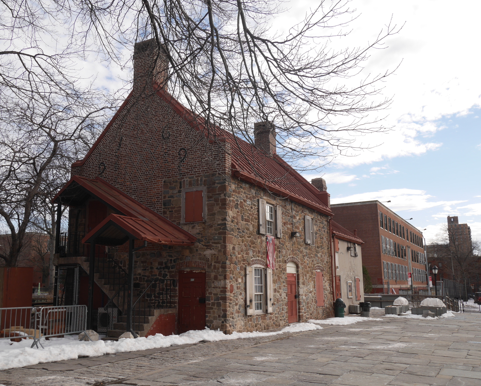
The site of that farm is the other especially interesting site related to the Battle of Brooklyn. The old farm is also a park—not a grand park like Prospect, but a small municipal park with a playground and athletic fields. In the middle of the park stands the Old Stone House. Originally built in 1699, the Vechte Farmhouse went to ruin and was demolished around 1900, but then in the 1930s the stones were dug up and the house reconstructed from drawings. The ground floor contains a small, free museum about the battle and its context.

The reconstructed Vechte farmhouse, Washington Park, Brooklyn.

The reconstructed Vechte farmhouse, Washington Park, Brooklyn.

The Old Stone House isn’t exactly the Vechte Farmhouse that stood there during the battle. It is a twentieth-century building made of seventeenth-century parts. But that doesn’t matter to me. What does matter is that there is plenty of continuity with the past, there and at other sites associated with the Battle of Brooklyn. There may be no national park for the battlefield, as there are for Saratoga and Yorktown. Instead, remnants of the eighteenth-century battle and its memorialization live on in twenty-first-century New York City.

Seventy years of Partition

It was seventy years ago today that India won its independence from the British Empire. Jawaharlal Nehru, the prime minister of the new country, described the winning of independence as India’s “tryst with destiny,” the culmination of decades of struggle.

Yet not one but two nations emerged from British India that fateful week in August 1947: India and Pakistan. The Indian National Congress of Mahatma Gandhi and Nehru had called for a unified secular state for all Indians, regardless of religion. The Muslim League of Muhammad Ali Jinnah wanted a separate homeland for South Asian Muslims, out of fear that Muslims would be a marginalized minority in a unified India.

Bending to pressure from the Muslim League, the British and Congress agreed to the partitioning of India on religious lines, with the two Muslim-majority regions becoming the eastern and western wings of Pakistan. (East Pakistan would become Bangladesh in 1971.) For Bengal and Punjab, states on the border, a commission led by British judge Cyril Radcliffe drew a new international boundary running between Muslim-majority and Hindu-majority districts within the states. The Radcliffe Commission consulted no other data aside from population statistics, and they conducted no field surveys.

The partitioning of India caused a refugee crisis on an unprecedented scale, as Muslims left India and Hindus and Sikhs left Pakistan. Ten million people were displaced and between 250,000 and one million killed.

Why so much bloodshed? Partition corresponded with a surge of violence between the religious communities. This violence was not spontaneous, as it is often remembered (when it is remembered at all). The Indo-British co-production Gandhi, released 35 years after Partition, includes a scene of refugees on the move near the new border. One column of Muslims trudges and rides bullock-carts toward Pakistan; the other, of Hindus and Sikhs, heads the opposite direction. One of the refugees flies into a rage and hurls a rock at the people heading the opposite direction. This unhinges an avalanche, and in short order both sides have fallen on each other and are cutting one another to pieces.

Episodes like this may have happened on occasion in real life, but the majority of the violence was premeditated, not spontaneous. It was also perpetrated not by amateurs, but by professionals—veterans of the Indian Army from World War II, with training and weapons that they could use for ethnic-cleansing.

The final episode of the British miniseries The Jewel in the Crown (based on Paul Scott’s Raj Quartet) has a more authentic portrayal of the violence of Partition. A band of Hindu militants stops a train and murders all the Muslim passengers. The militants know where to look because one of their conspirators left chalk marks on the exterior of the carriages at an earlier station stop.

Only a small minority of Indians, Pakistanis, or Bangladeshis are old enough to remember Partition; but the scars of the event are almost everywhere in South Asia. There is of course the Indo-Pak border, and the seventy years of suspicion and hatred that it represents. In Pakistan, the province of Sind lost its business class, almost all Hindus, who migrated to India. (Some of them ended up in Jaipur, where their descendants run shops in the old city.) In India, Uttar Pradesh (formerly the United Provinces) lost its Muslim upper class to Pakistan. Hindustani, the common language of northern India, was split definitively into Hindi in India and Urdu in Pakistan. Urdu and the Muslims who spoke it were second-class citizens in India. Jinnah’s prediction had in a way become a self-fulfilling prophecy.

Learn more

  • The Great Partition, by Yasmeen Khan, is an account of the human toll of Partition. Not for the faint of heart.
  • Midnight’s Descendants, by John Keay, begins with an excellent discussion of Partition. (The rest of the book, alas, is not so good.)
  • The works of Urdu short-story writer Sa’adat Hasan Manto are still read on both sides of the Radcliffe Line. (Hindi speakers read Devanagari transcriptions.) Some of them have been translated into English (including my favorite, “Toba Tek Singh”). Manto’s life story is itself a parable of Partition: Formerly comfortably ensconced in Bombay, he moved to Pakistan for his wife’s family, where he wrote stories of Partition and drank himself to death.

Page 26 of 44

Powered by WordPress & Theme by Anders Norén