WillyLogan.com

Technology, History, and Place

Page 35 of 44

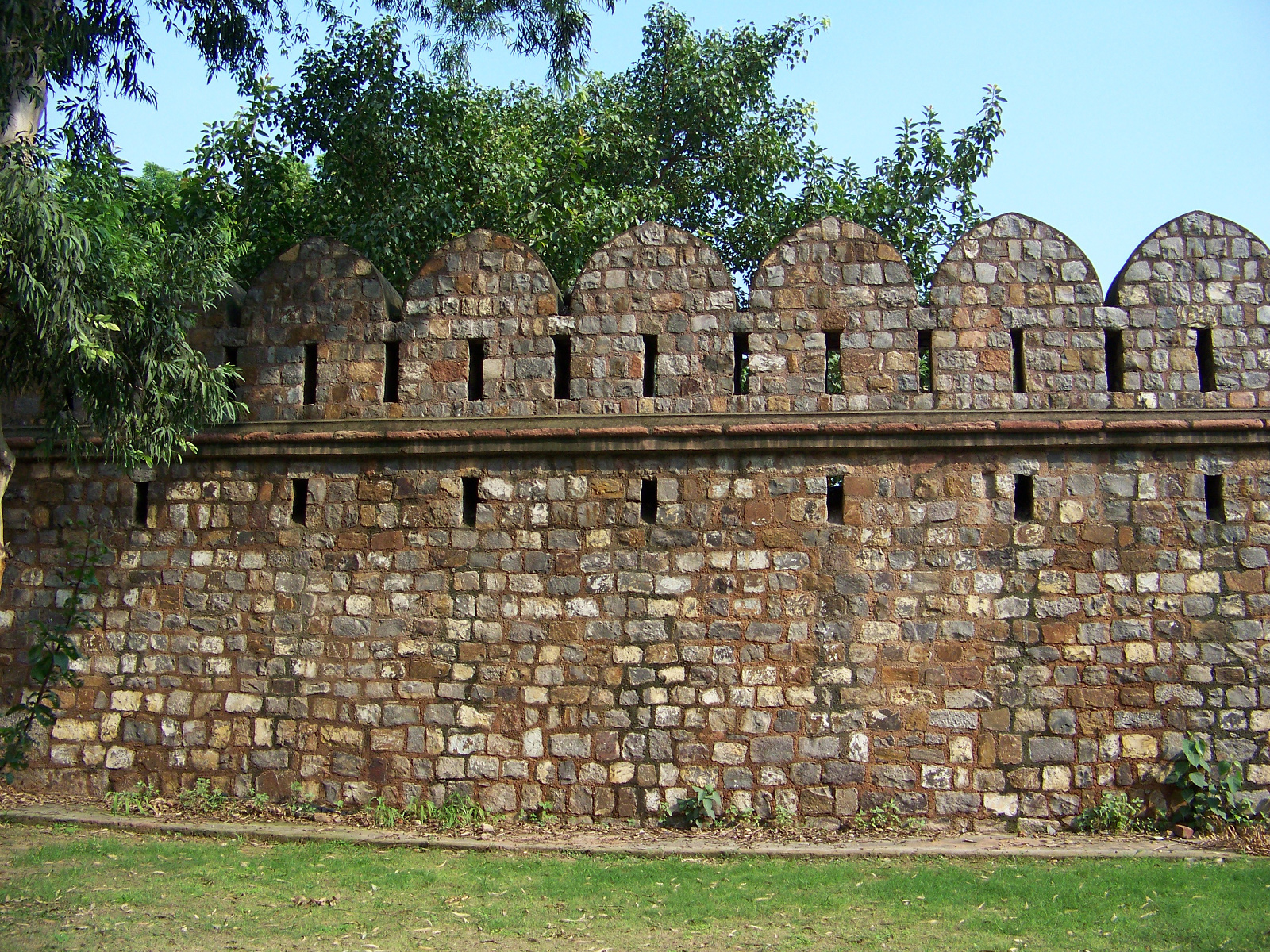
4341-delhi-wall-crenelations_1600px

Old Delhi’s walls and gates

The remains of the fortifications of Old Delhi don’t make it onto most tourists’ itineraries when they visit the city. This is understandable, because Old and New Delhi have a range of world-class tourist attractions – such as the Red Fort, Qutb Minar, and Lutyens’ Delhi – which overshadow the city walls. But as I have found on several visits to Delhi, exploring the remains of the fortifications can be a rewarding experience. From my visits to the gates and walls, I have learned about urban planning, military science from several eras, and adaptive reuse.

Old Delhi was founded in 1639 by Mughal emperor Shah Jahan, who wanted to move his capital to a more suitable location than Agra, which was experiencing problems with drainage, overcrowding, and erosion. The original name of Old Delhi was Shahjahanabad, after the city’s founder. The centerpiece of Shahjahanabad was the Qila Mubarak (Blessed Fortress), now known as the Lal Qila or Red Fort. The fort stands on the eastern side of Shahjahanabad, with its back to the Yamuna River. It served as the royal palace and center of the Mughal government. To the west of the fort, an area of about 1,500 acres was enclosed by city walls built of stone rubble. The walls were broken by eight main gates and several lesser portals.

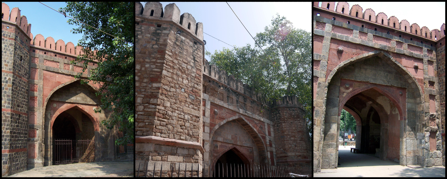
The walled area of Old Delhi still retains its historic identity. It even has its own postal code, 110 006, and it is colloquially referred to as “Delhi-6.” Only fragments of the walls and four of the eight main gates remain, though. On the southern side of Old Delhi, Ajmeri Gate, Turkman Gate, and Delhi Gate still stand on little plots of land, disconnected from the historic walls and surrounded by their own fences and gates.

Left to right: Ajmeri Gate, Turkman Gate, Delhi Gate.

Left to right: Ajmeri Gate, Turkman Gate, Delhi Gate.

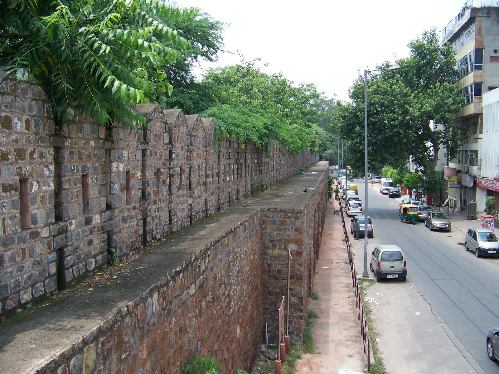
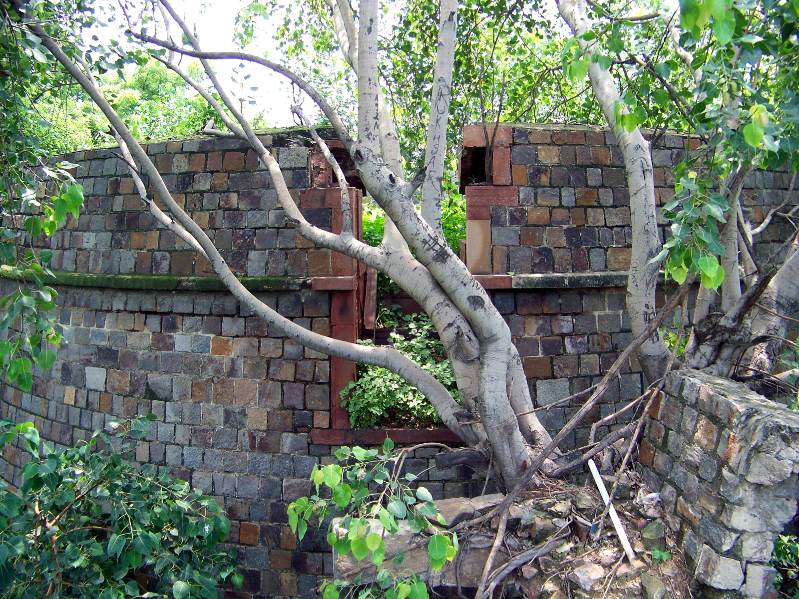
Stretching eastward from Delhi Gate are some sections of the old city wall. One stretch of the wall is preserved in a city park, Ekta Sthal (Place of Unity). Only the outer side of the wall is protected, though. The inner side backs up to an alley, and there are several encroachments and illegal constructions built on the historic wall.

Backside of preserved wall segment in Ekta Sthal.

Backside of preserved wall segment in Ekta Sthal.

View from ramparts of Delhi's walls.

View from ramparts of Delhi’s walls.

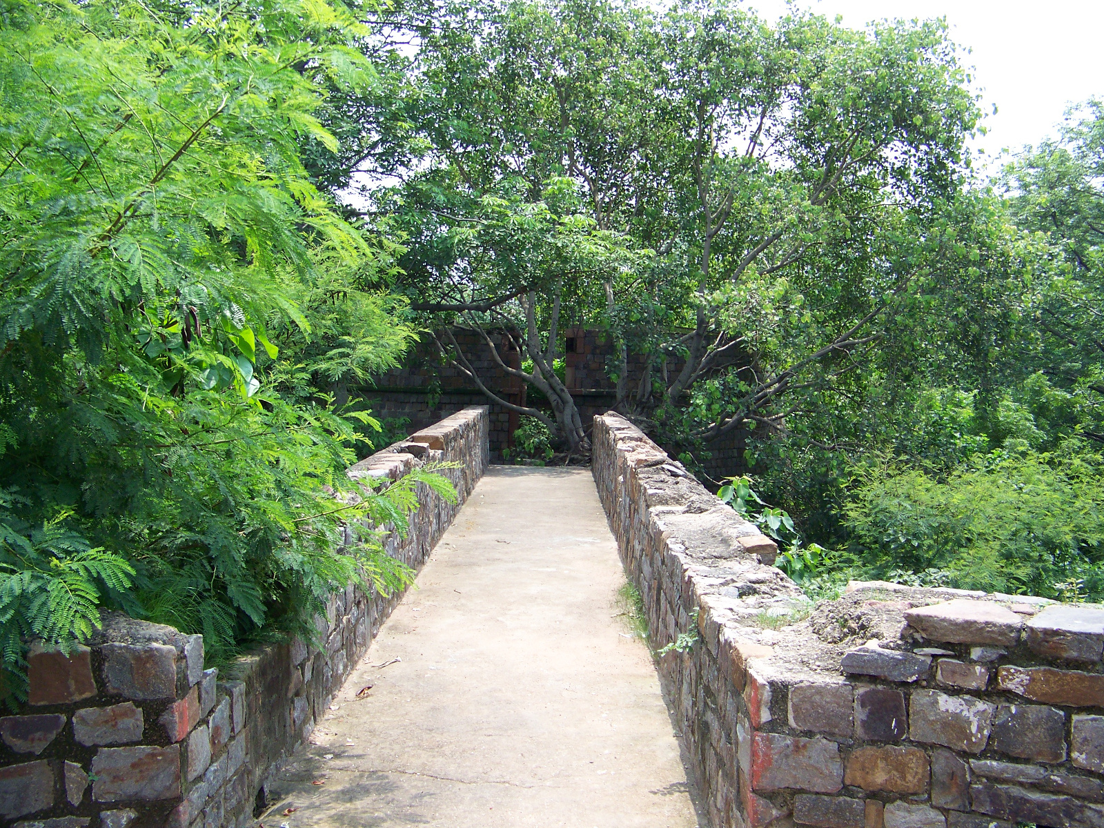
One ramp up to the battlements hasn’t been encroached upon yet, and you can climb up and have a look around. From here you can see a round tower built in front of the wall. The tower doesn’t seem to match the style of the rest of the wall – and it shouldn’t, because it was built by the British in the nineteenth century. It is a Martello tower, designed to hold cannons and serve as an outer defensive post. The British built Martello towers all over their world empire in the nineteenth century.

Walkway to Martello tower.

Walkway to Martello tower.

Martello tower ruins.

Martello tower ruins.

Northeast of Ekta Sthal and the Martello tower, sections of the city wall now serve as retaining walls beneath more modern construction.

Remaining city wall serving as a retaining wall.

Remaining city wall serving as a retaining wall.

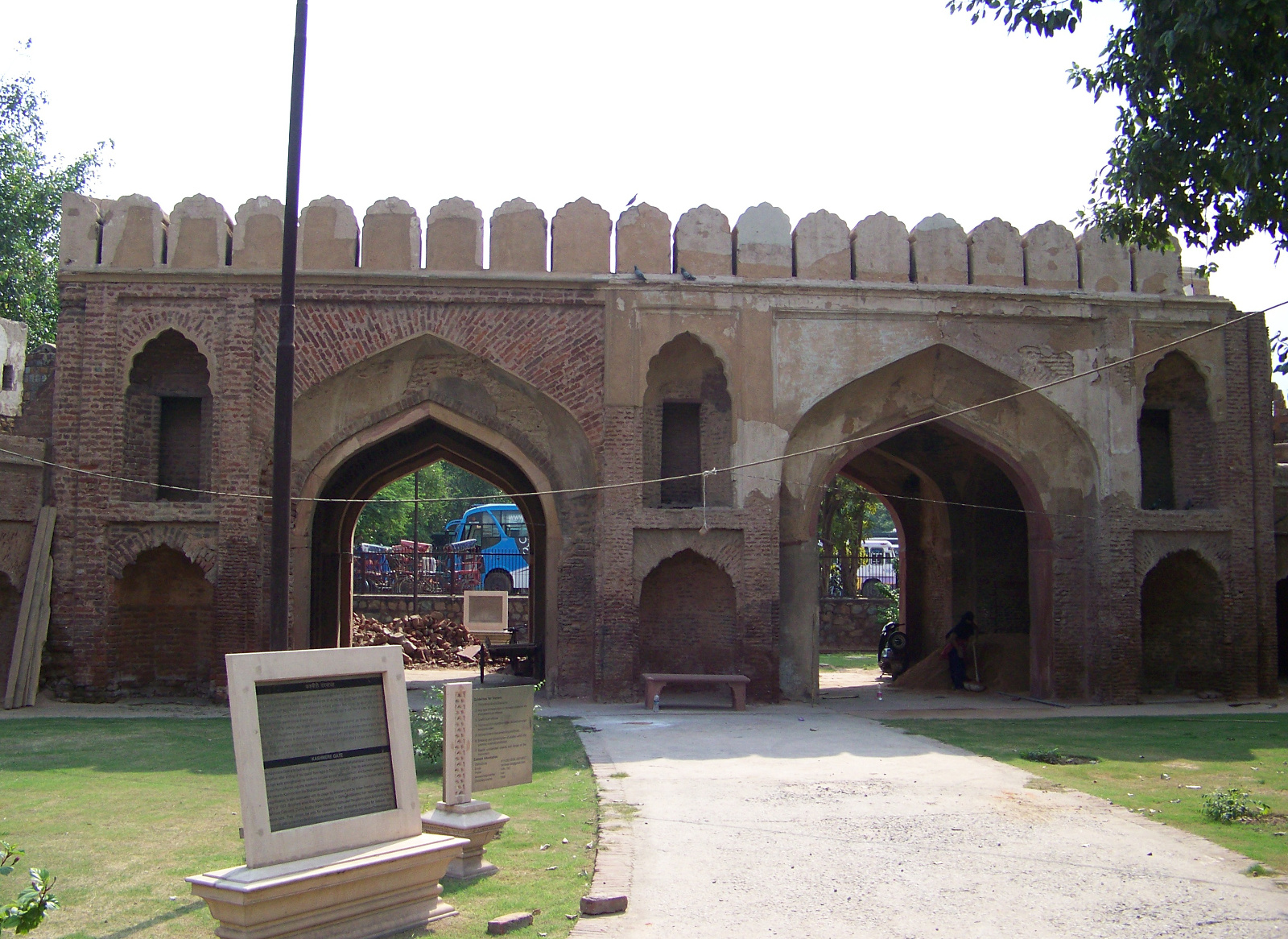
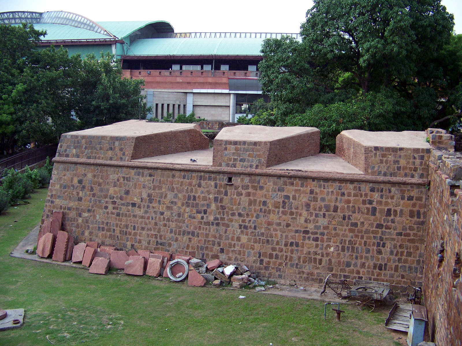
The longest stretches of surviving wall are on the north side of Shahjahanabad, around Kashmiri Gate. Parts of the city’s fortifications are still attached to Kashmiri Gate. Unlike Ajmeri, Turkman, and Delhi Gates, the surviving structure of Kashmiri Gate wasn’t built until the nineteenth century. The gate was constructed in 1835, and then in 1857 it was expanded to have two portals. A bastion next to the gate is built in angular star-fort style, a form of construction that was introduced to India by the British.

Kashmiri Gate, Delhi's only gate with two portals.

Kashmiri Gate, Delhi’s only gate with two portals.

A European-style bastion next to Kashmiri Gate.

A European-style bastion next to Kashmiri Gate.

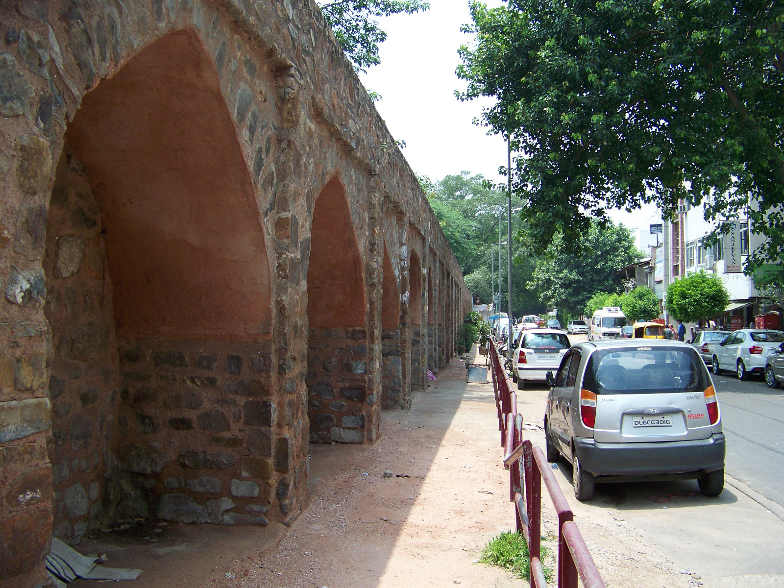
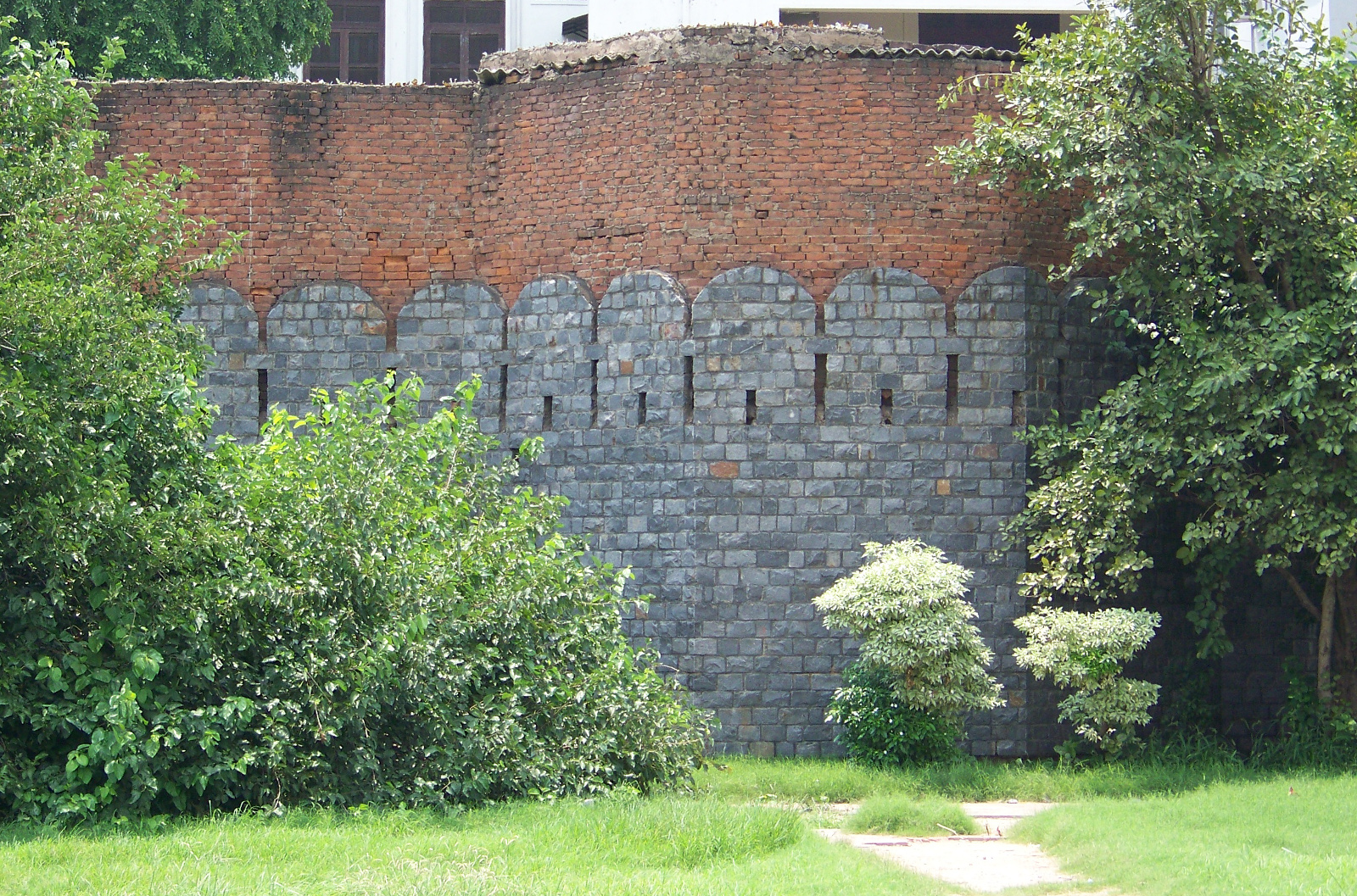
Sections of city wall still stand on both the east and west sides of Kashmiri Gate. The sections on the east side are protected from encroachment by a metal fence. The sections on the west are not protected at all. Holes have been punched in the walls here and there. The arches under the battlements are used for stabling livestock and storing hay and building materials. When I visited the unprotected section of wall, I didn’t feel comfortable playing tourist and snapping picture after picture. I felt the same way that I would feel taking pictures of a stranger’s house. The walls are historic landmarks, but they are also places where some Delhiities live and work.
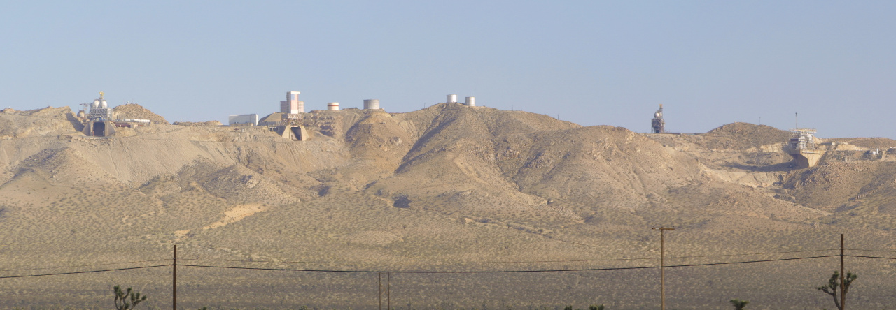
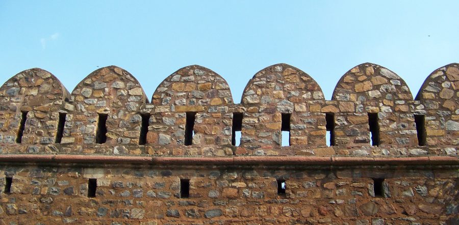
One of the preserved sections of wall near Kashmiri Gate.

One of the preserved sections of wall near Kashmiri Gate.

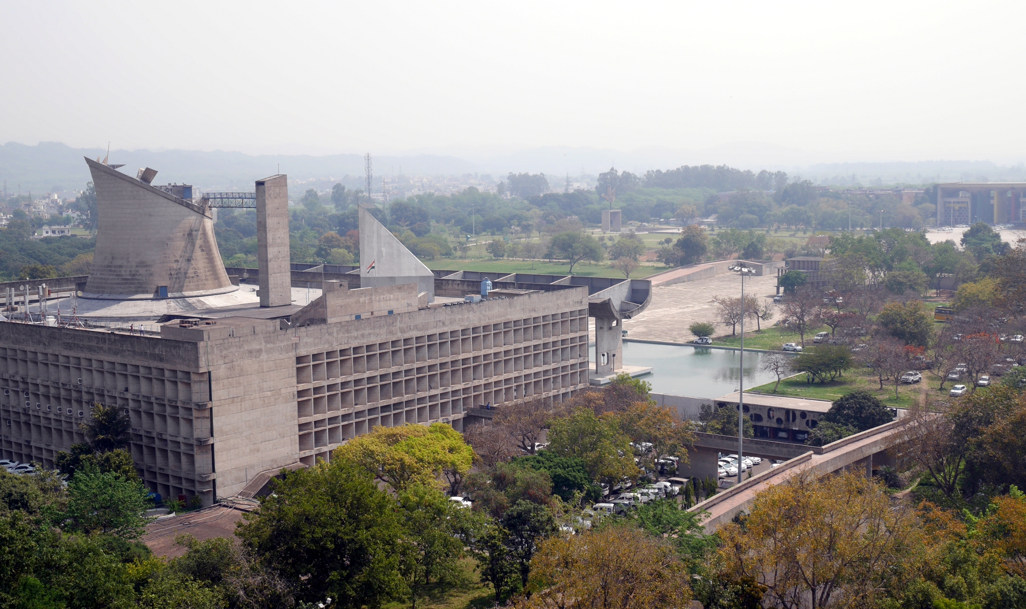
Panoramic view from the Chandigarh Secretariat.

Report on the City Beautiful

The Legislative Assembly in Chandigarh, designed by Le Corbusier.

The Legislative Assembly in Chandigarh, designed by Le Corbusier.

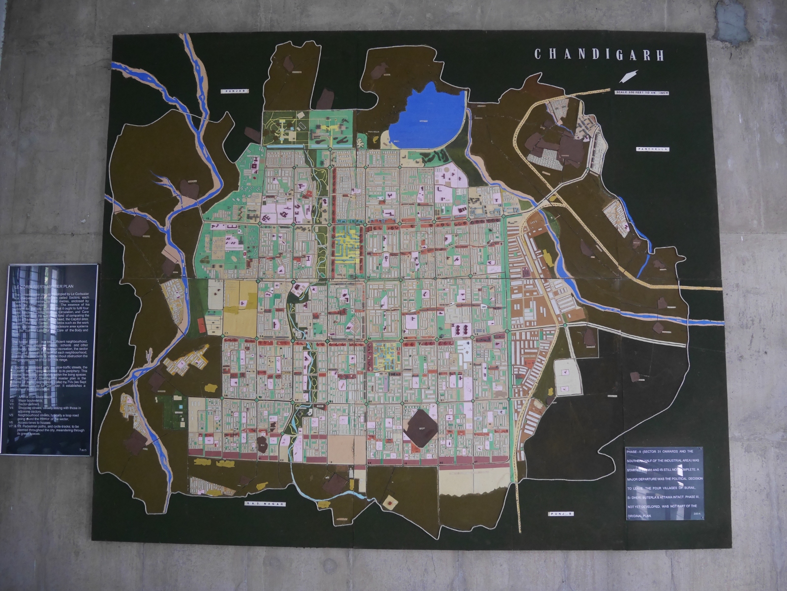
I remember the first time I heard about Chandigarh, the planned capital of the Indian states of Punjab and Haryana. It was during my first sojourn in India, after I had already spent several months exploring the country. It was a long and boring Saturday afternoon, and I was looking at the Rough Guide to India. I came across the city map of Chandigarh, which has perfectly rectangular, uniformly-sized blocks. I thought: Huh? I was used to seeing Indian cities that had been laid out haphazardly, so how did Chandigarh get to be built on a grid?

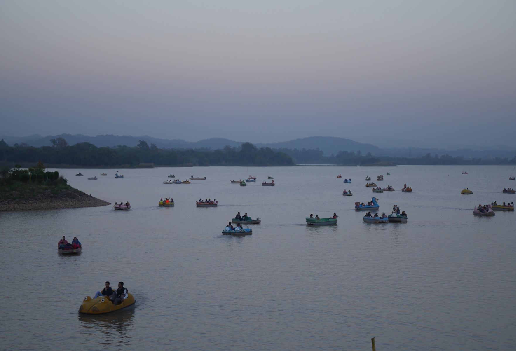
As I learned later, Chandigarh was built after Partition to replace Lahore, the traditional capital of Punjab, which was now in Pakistan. (At this time, Punjab and Haryana were a single state.) Prime Minister Nehru was in favor of building a totally modern capital for Punjab, to represent India’s arrival on the world stage as a modern nation. The individual who gets most of the credit for designing Chandigarh was the Swiss-born architect and prophet of modernism Le Corbusier. In reality, Le Corbusier was not the sole creator of Chandigarh, as he modified a town plan worked out earlier by the American architect Albert Mayer. The first phase of Le Corbusier’s plan, which ended up getting built with some further modifications, called for twenty-nine numbered sectors separated by huge landscaped boulevards. The state government buildings are in the Capitol Complex in Sector 1, and the main commercial district is Sector 17. Northeast of the city, in Sector 6, is a large city park centered around Sukhna Lake, an artificial lake impounded by a long embankment.

The town plan of Chandigarh, as portrayed in the city museum.

The town plan of Chandigarh, as portrayed in the city museum.

Paddleboats on Sukhna Lake.

Paddleboats on Sukhna Lake.

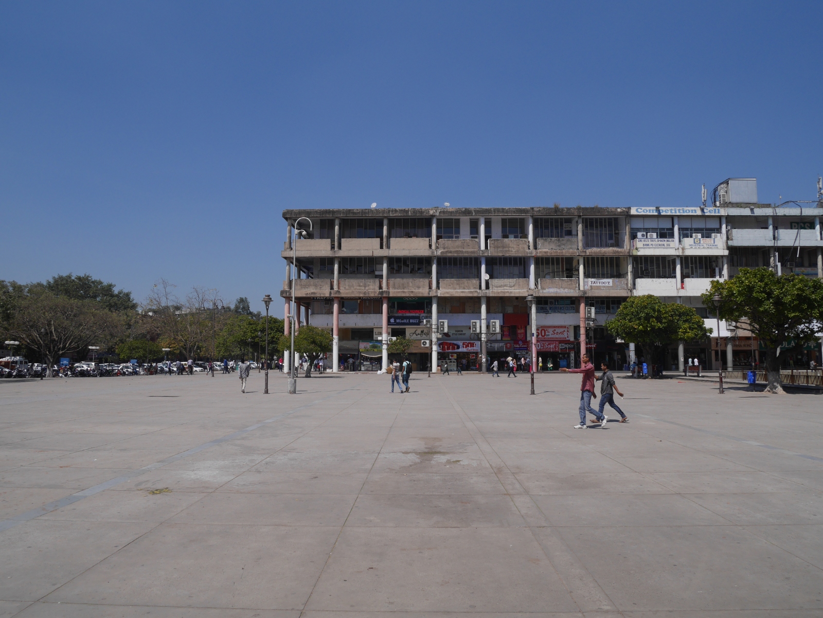
Chandigarh has gained a certain notoriety for its unusual town plan. The scale of the city makes it impossible to get anywhere by walking. The population density is too low to support a metro, and the city buses run infrequently. More than anywhere else in India, the people of Chandigarh have to rely on private automobiles to get around their city. In fact, Chandigarh is the only place in India that has more registered motor vehicles than people. (This includes scooters and motorbikes as well as cars.) The shopping center at Sector 17 is so large and sparse that it is never crowded and bustling like the commercial districts of other Indian cities. James C. Scott devoted a couple of pages to Chandigarh in his seminal critique of authoritarian high-modernism, Seeing Like a State: How Certain Schemes to Improve the Human Condition Have Failed (1998). He included a black-and-white photo of Sector 17, which looks like a massive concrete wasteland with a few tiny human figures standing in it.

My attempt at recreating the photograph of Sector 17 in Scott's Seeing Like a State.

My attempt at recreating the photograph of Sector 17 in Scott’s Seeing Like a State.

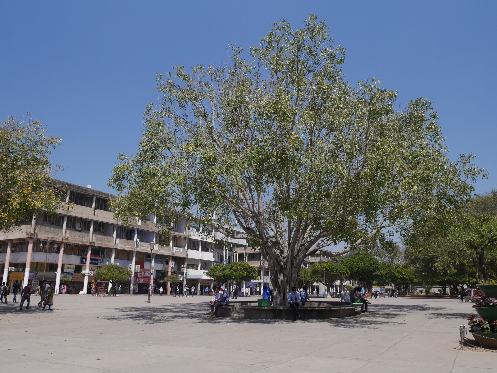
Five years after first learning about Chandigarh, I have finally gotten a chance to visit the city. I could not draw any definitive conclusions about Chandigarh from a few short days there, but I did see enough to conclude that dire reports of the city’s poor planning and un-Indianness are exaggerated. While I do agree that it was foolish to make the city as big and spread-out as it is, it is still unmistakably an Indian city. Although private cars and motorbikes dominate the roads, there are also plenty of cycle rickshaws, autorickshaws, bicycles, and even horse carts. Sector 17 is a little bigger than it needs to be, but I feel that the austere photograph in Scott’s book misrepresents the place. It was likely taken early in the city’s life, before the place had had a chance to mature. In 2015, the shops around Sector 17 have brightly printed signs above them, like shops everywhere else in India. Far from being a concrete wasteland, the plaza in the middle of Sector 17 now has pipal trees and park benches in it.

A pipal tree in Sector 17, Chandigarh.

A pipal tree in Sector 17, Chandigarh.

Chandigarh is certainly unusual, but it is not exceptional in India. Planned towns in the Indian subcontinent date back to antiquity. Harappa and Mohenjo-Daro, two archaeological sites in present-day Pakistan, are the remains of two nearly identical cities built more than three thousand years ago. Although we know nothing about Harappan society, it is clear that they had a strong and centralized government that was able to enforce the town plan. Texts from later Indian antiquity describe the ideal city as a large square subdivided into square blocks, with the king’s palace in the central block. It is not clear whether such a city was actually constructed in antiquity, although the builders of Jaipur did follow the ancient guidelines when they laid out their city in the early eighteenth century.

The arrival of British colonists brought European-style town planning to India. Some Indian towns still have cantonment areas laid out in perfect grids for the British who once occupied them. Since independence, extensions of many existing Indian cities have been built on lines similar to Chandigarh. For example, Dwarka Sub-City in Delhi National Capital Territory was laid out by the Delhi Development Authority. (Other cities have similar agencies overseeing their expansions.) Dwarka is not built on a perfect grid, but it is built sector-by-sector with large streets separating the sectors. It does not seem to be a very efficient use of space. The Delhi Metro runs through Dwarka, but much of the sub-city is not convenient to the metro. The housing societies are built for people who own their own cars.

Apart from the scale, the most significant difference between Chandigarh and Dwarka is the underlying motive for construction. From start to finish, Chandigarh is infused with modernist ideology; it declares that India has arrived as a modern nation. Dwarka, on the other hand, is just a place for middle-class people to live.

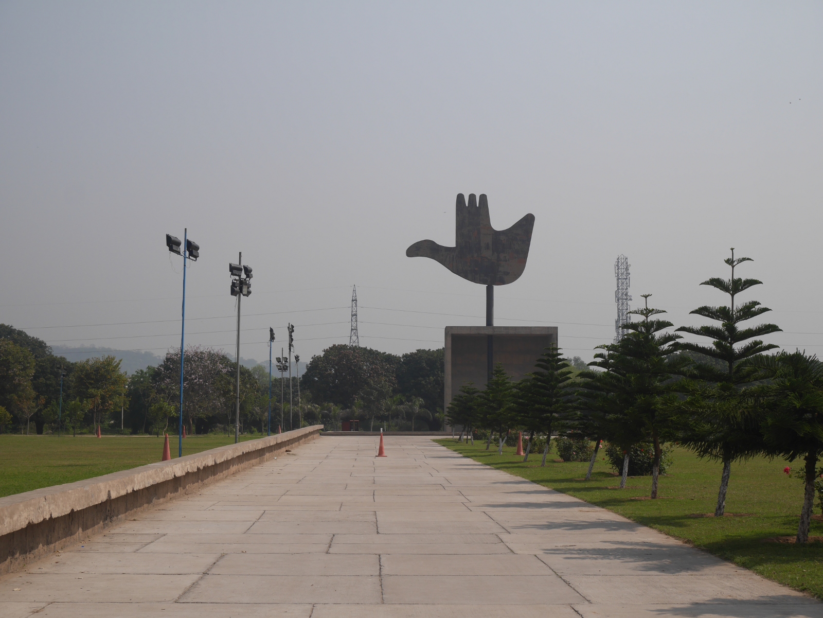
Chandigarh's Open Hand Monument, designed by Le Corbusier but not constructed until 1985.

Chandigarh’s Open Hand Monument, designed by Le Corbusier but not constructed until 1985.

Phones in the United States and India (part 2)

Compared to mobile phones, an even more recent arrival in India is the smartphone. In 2009, smartphones were unheard-of in the Garo Hills. I don’t remember ever seeing them anywhere I went in north and northeast India either. By 2013, smartphones were more in evidence in Jaipur when I spent the summer there, but more in TV ads than real life. Now in 2015, smartphones are becoming increasingly ubiquitous. When I ride the Delhi Metro, half of the passengers are fiddling with smartphones, reading something in English, Hindi, or Punjabi, or playing a game. Apple iPhones are not as common in India as the USA, since most people don’t care to pay the premium price. The Samsung Galaxy is much more common as a prestige phone. There are also several indigenous brands not seen in the USA, such as Micromax.

What is remarkable to me about smartphones in India is that they are being adopted by a wide range of social classes. There is nothing remarkable about the privileged urban youth of India using smartphones in 2015, although I feel that they try too hard to prove that they have arrived in the twenty-first century by taking too many selfies and signing up for all of the social media services, and then posting all of those selfies, and anything else they think or do, on all of the services. They aren’t just using the usual suspects like Facebook, Instagram, or Twitter, but also services I’d never heard of before coming to India this time.

What I do find remarkable is that some manual laborers and service workers, like the maid who works in the house where I stay in Delhi, have started using smartphones. Non-smartphones have not been marginalized in the market as definitively as they have been in the West, but it is clear to me that for certain classes of Indians, smartphones are now the only socially acceptable option. This is not the case for lower classes, but it is worth noting that lower-income groups now have access to the same technology that the privileged classes are using for status symbols.

Mobile phones gave many members of lower-income and rural populations access to their own phones for the first time. In the same way, smartphones are making the Internet more widely accessible. In the Garo Hills in 2009, when I wanted to check my e-mail, I had to hitch a ride to the nearby town and pay Rs. 40 an hour to use a slow, unreliable cell-network connection at a computer services shop. Sometimes I would arrive and the power would be out, or the manager would be away, or the connection would inexplicably not be working. This was an all-afternoon outing, and I could only make it once every week or two. I went to the effort to access the Internet because I had already become reliant upon it from my life in the West. For those who had never used the Internet before, it wasn’t likely that they were going to go out of their way to start using it there. Now, the growing number of smartphone users can access the Internet whenever they want, without having to go anywhere.

It is much too early to make any conclusions about what all of this means for Indian society. Are smartphones an egalitarian technology, like non-smartphones? TV ads that show sequestered women in rural Haryana using their smartphones to access educational resources would have you believe so. Of course, TV ads playing on the same channels also claim that “Love and Nourish” soap will give you perfect skin like Kareena Kapoor, and “Juzt Jelly” candies will give you the strength of the children’s cartoon hero Chhota Bheem. In the case of smartphones, though, this technology may indeed give economically disadvantaged people access to knowledge resources that were too expensive to access beforehand. Or smartphones might prove to be just a passive form of entertainment, opening the way for huge sections of the Indian population to become addicted to the next “Candy Crush.” I suspect that smartphones in India are already on their way to proving themselves as both useful tools and useless toys.

Page 35 of 44

Powered by WordPress & Theme by Anders Norén