WillyLogan.com

Technology, History, and Place

Tag: Jaipur (Page 1 of 3)

By flying boat across India

In 1941, as war clouds loomed over southeast Asia, a Chicago News correspondent by the name of George Weller flew from Cairo to Singapore on assignment. In Singapore, Weller reported on the British Empire’s ineffectual preparations for an attack that was sure to come from Imperial Japan. When the attack did come, it was not from the sea—as the British expected and were prepared for—but through the jungles of Malaya. Weller reported on the Japanese forces’ astonishingly effective campaign down the Malayan Peninsula and the subsequent doomed defense of Singapore. He was there until almost the very end, when the remaining British Empire forces in Singapore surrendered on February 15, 1942. The following year, he published his firsthand account of the fall of Malaya and Singapore, the engrossing Singapore Is Silent.

Japanese troops parading in Singapore after the fall of the city. [Source: Wikimedia Commons, PD]

Japanese troops parading in Singapore after the fall of the city. [Source: Wikimedia Commons, PD.]

Something that I found particularly interesting in Singapore Is Silent was Weller’s account of his flight from Cairo to Singapore. The two cities are a little over 5,100 miles apart by the great-circle route, which runs mostly over the Indian Ocean and only crosses the southern part of peninsular India. A flight like this would be no big deal with a modern long-range airliner like a 787 (even thought it seems that there are currently no airlines offering direct service between Cairo and Singapore). But this was far beyond the range of the airliners of the day.

A Short Sunderland Mk V in military (RAF) service. [Source: Wikimedia Commons, PD.]

A Short Sunderland Mk V in military (RAF) service. [Source: Wikimedia Commons, PD.]

In Singapore Is Silent, Chicagonews (as Weller calls himself in the narrative) flies to Singapore aboard a Short Sunderland operated by British Overseas Airways Corporation (BOAC). The Sunderland was a flying boat, so it could only take off and land on water. The plane had a maximum range of 1,780 miles, which meant that it had to stop several times to refuel on its way to Singapore. BOAC routed its plane north of the great-circle route, sending it across northern India, where there were plenty of places to stop. Chicagonews’s route across India was this: Karachi (still a part of India at this point), Jaipur, Allahabad, “the narrow upper waters of the Ganges” (no city name specified), and Calcutta.

Karachi is on the coast and Allahabad and Calcutta are on the Ganges (Ganga) river system, but what about Jaipur? It is in arid Rajasthan, with no ocean or large river in sight.

Chicagonews’s plane touches down on “the Rajah’s lake near Jaipur,” where a motor launch takes the passengers to shore. This was clearly one of the artificial lakes around Jaipur. Although I have not been able to find a source to tell me which one it was, I think that it was most likely Jamwa Ramgarh, an irrigation reservoir 15 miles northeast of the city that was built in 1901. With a long axis of about 4½ miles, the lake would have been long enough for the takeoff run of a big flying boat.
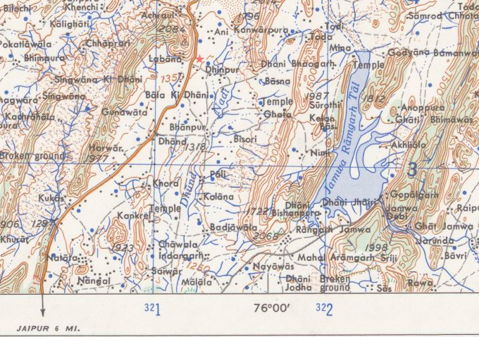
Jamwa Ramgarh Tal, as pictured on a 1963 US Army Map Service map. The lake has been dry since 2000. Source: Perry-Castañeda Library Map Collection.

Jamwa Ramgarh Tal, as pictured on a 1963 US Army Map Service map. The lake has been dry since 2000. [Source: Perry-Castañeda Library Map Collection.]

The route crossing India by flying boat was a recent development. In the late thirties, Imperial Airways (BOAC’s predecessor) had taken its flying boats only as far as Karachi; for the crossing of India itself, passengers had transferred to landplanes and flown a route of Karachi–Jodhpur–Delhi–Allahabad–Calcutta. When Imperial Airways introduced flying boats for the crossing of India, the route was changed to Karachi–Rajsamand Lake (near Udaipur)–Gwalior–Allahabad–Calcutta.

The age of overseas travel by flying boats was brief. Long-distance routes like BOAC’s Cairo-Singapore were disrupted by Axis conquests during World War II. By the end of the war, land-based planes had become bigger, faster, and longer-ranged, so airliners could make overseas flights with fewer intermediate stops. For example, BOAC adopted the Boeing 377 in 1949, which had a range of 4,200 miles, more than twice the range of the Short Sunderland from just a decade earlier. The Boeing 707, which BOAC adopted in 1960, had a long enough range that it could fly all the way from Cairo to Singapore without making any stops at all in between.

The airport in Jaipur (now a strictly land-based airfield in Sanganer on the south side of the city) is no longer a stopover point for international flights. Long-range planes can simply bypass Jaipur on their way to bigger airports. Jaipur International Airport (JAI) does have direct flights to Dubai, but otherwise its traffic is domestic.
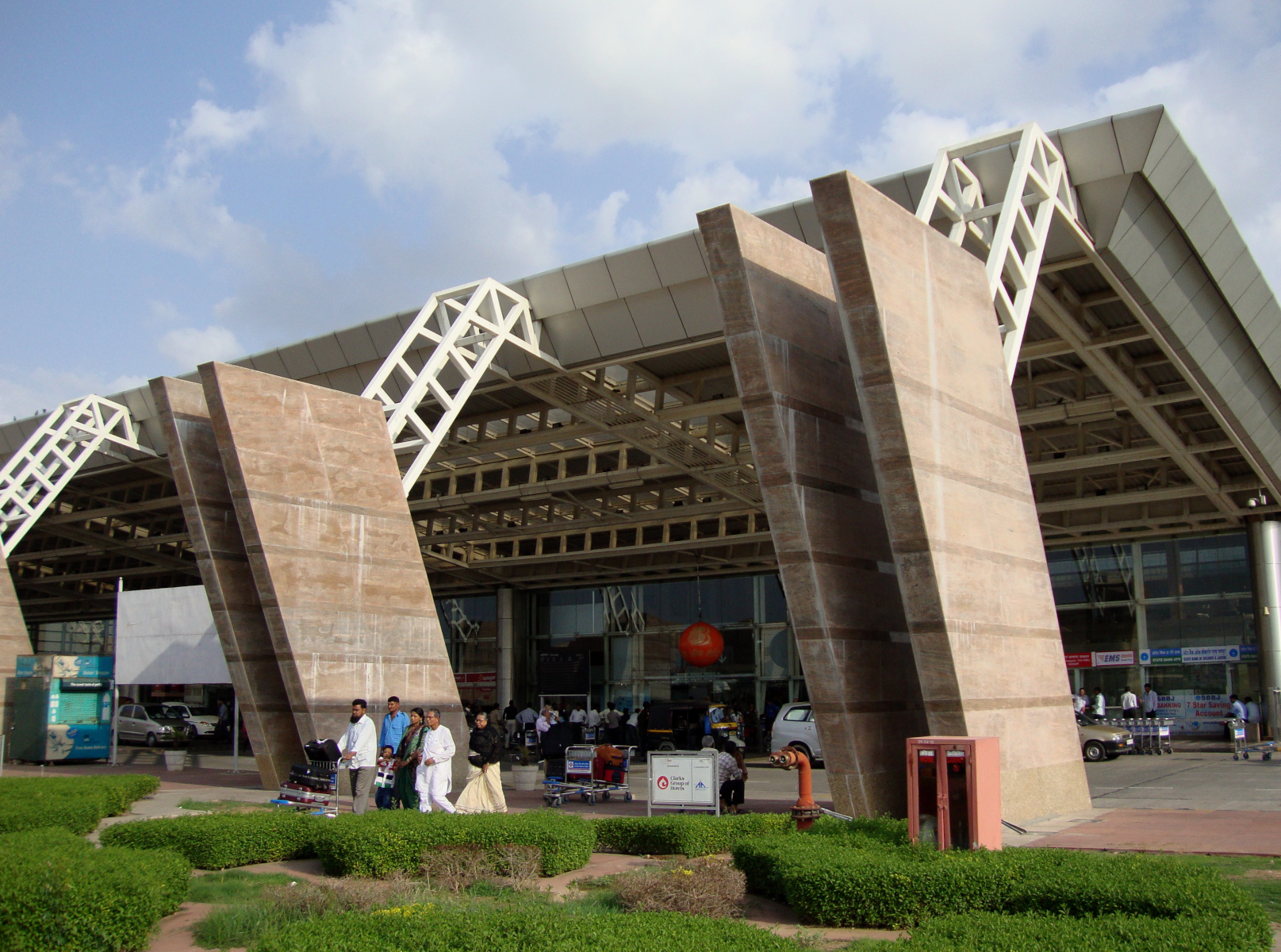
JAI terminal building

The modern terminal building at Jaipur International Airport.

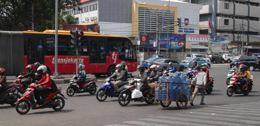
Traffic on Pasar Senen, Jakarta.

Jakarta’s bus-metro

Before visiting Jakarta three years ago, I read someplace that the Indonesian capital may be the largest city in the world without a metro railway. A couple of other cities could contest that claim, but Jakarta is certainly one of the biggest metro-less cities.

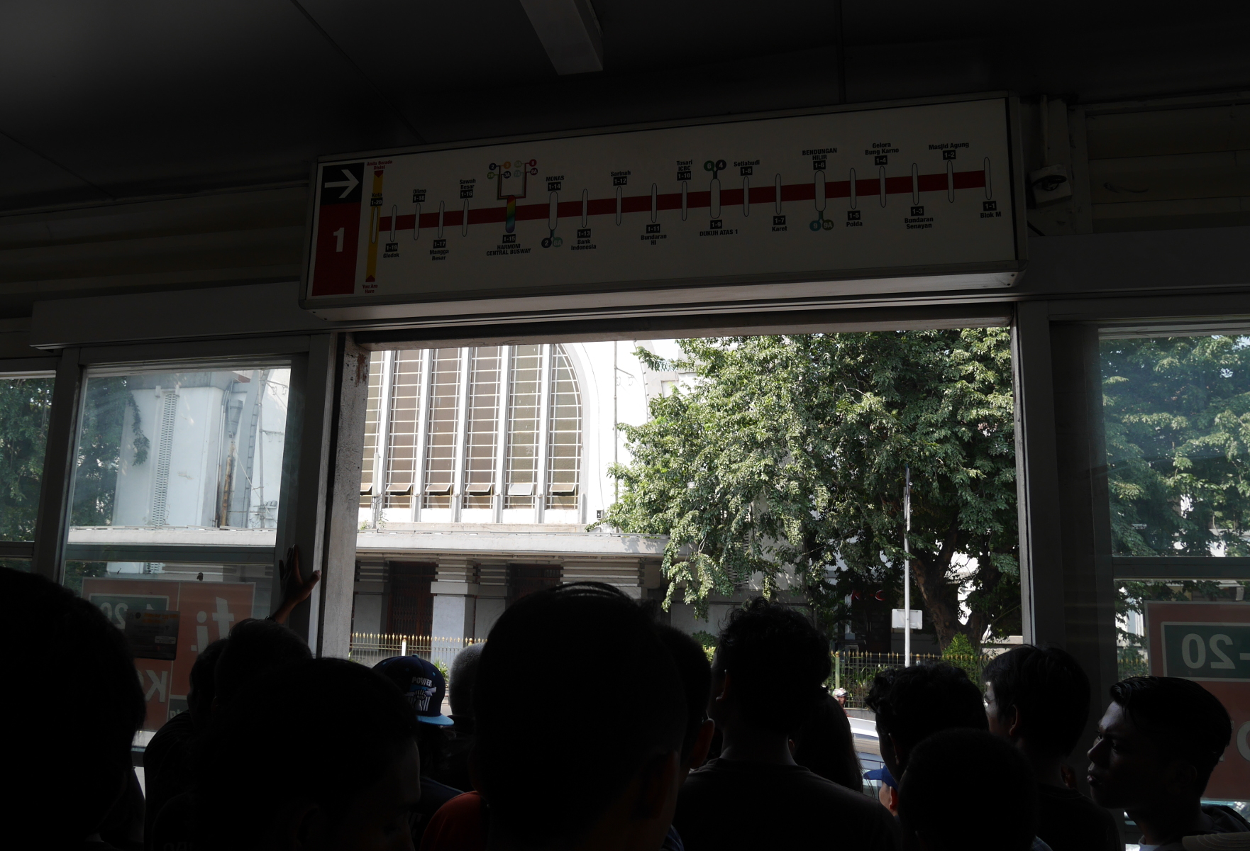
Instead of a metro railway, Jakarta has the Transjakarta Busway, a hybrid transportation technology that is effectively a bus metro. The buses run in their own lanes and stop at stations that can only be entered with a smartcard. The bus doors are high off the ground to meet the station platforms, so it is only possible to board the buses through the stations. There can still be quite a gap between bus and platform, more than on any metro I’ve ridden.

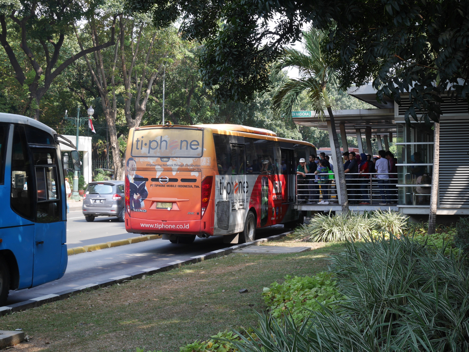
Buses at a Transjakarta station.

Buses at a Transjakarta station.

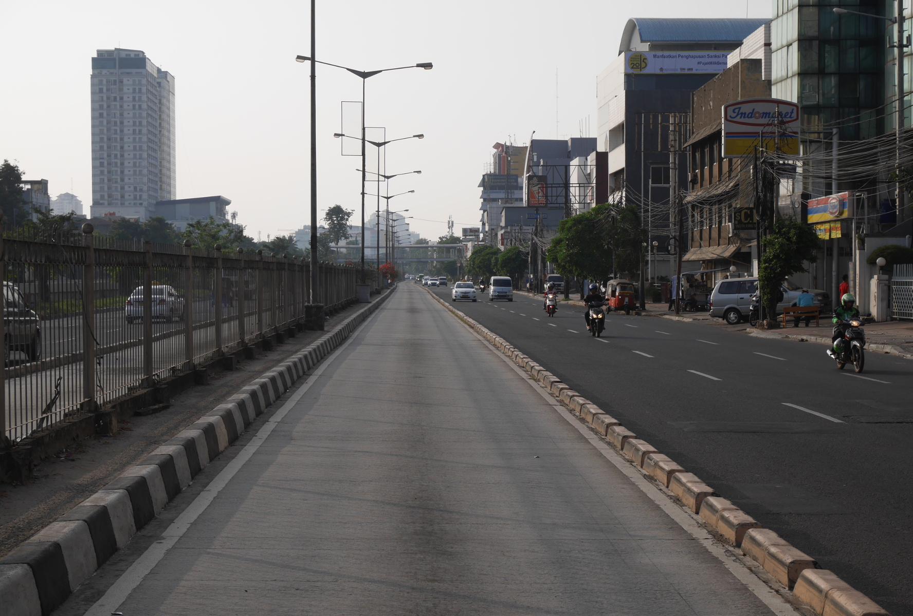
A dedicated busway lane on Jalan Gunung Sahari.

A dedicated busway lane on Jalan Gunung Sahari.

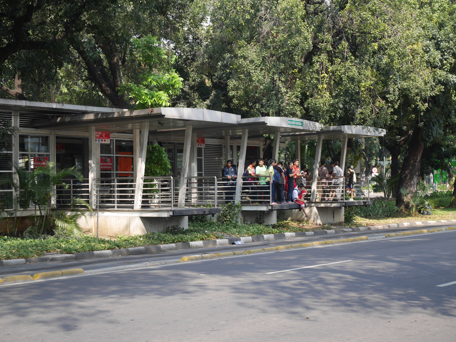
A busway station

A busway station

Interior of another busway station.

Interior of another busway station.

At its best, the Transjakarta Busway is faster and more efficient than regular buses, which are at the mercy of all the other traffic in a city. It was also much cheaper to build than a metro railway, because the buses run on existing roadways rather than purpose-built tunnels. At its worst, the busway may not offer much advantage over regular buses, because traffic doesn’t always stay out of the designated bus lanes.

Jakarta was the first place I saw a busway, but then when I went to Yogyakarta in south-central Java, I found a small busway system in that city as well. When I moved to Jaipur later that year, I saw what appeared to be the ruins of a rapid-transit bus system. On one of the roads on the western side of the city, buses ran in their own dedicated lanes, but the lanes were not always open, and at other times non-bus traffic infiltrated the lanes.

To return to Jakarta: there is a metro railway under construction in Jakarta, but it has yet to open. When it does, the Transjakarta Busway will probably continue to operate alongside it.

Metro construction on one of the boulevards of Jakarta, 2015.

Metro construction on one of the boulevards of Jakarta, 2015.

Indonesia has two other public transportation technologies that are worth mentioning: ojeks and becaks. Ojeks are motorcycle taxis. The passenger sits on the back of the motorcycle behind the driver. Thanks to their narrow profile, ojeks can weave through traffic. I understand that motorcycle taxis are common elsewhere in southeast Asia. It seems that they could be popular in India as well, but they have not caught on there for some reason—possibly because they would not be practical for women traveling alone.

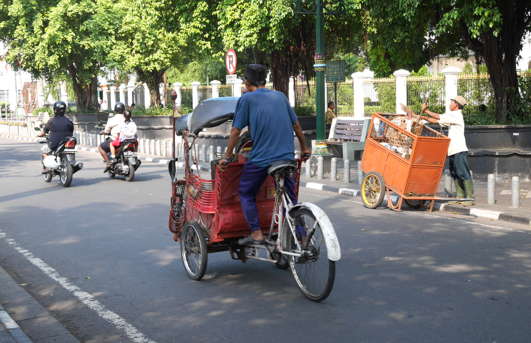
The other distinctively Indonesian mode of public transit is the becak, a three-wheeled cycle-taxi. (The c in “becak” is said like ch in “change.”) Unlike the cycle-rickshaws of India or the trishaws of Malaysia, becaks have a passenger seat in the front, and the driver sits in the back. The use of becaks has fallen off considerably in recent decades, but they are still around, especially in touristy areas.

A becak in Yogyakarta.

A becak in Yogyakarta.

wlm2016 header_3

Willy Loves Monuments 2016

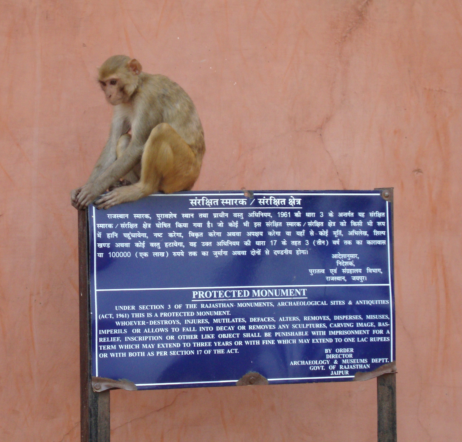
A rhesus macaque sits on a sign identifying the Sun Temple at Galta-ji (Jaipur) as a Rajasthan state protected monument.

A rhesus macaque sits on a sign identifying the Sun Temple at Galta-ji (Jaipur) as a Rajasthan state protected monument.

Last month, the Wikimedia Foundation staged a contest called Wiki Loves Monuments 2016. Users uploaded photos of national- and state-level protected monuments in participating countries (including India), and a jury would select the best photos in certain categories.

On September 1, I found out about WLM 2016 when I looked at Wikimedia’s most popular website, Wikipedia. A banner below the search bar announced: “Photograph a monument, help Wikipedia, and win.” I was delighted. Although I held no illusions that any of my photos would win a prize, I felt as if this contest had been made for me, and I for it. I’d spent the past year visiting all the protected monuments in Jaipur I could find. WLM 2016 gave me a reason to visit more of them. I went to some I had never seen before, and I also returned to some familiar monuments to take better pictures expressly for contribution to WLM 2016. In all, I uploaded 31 pictures of 19 different monuments, all but three of which are in Jaipur.

Wikipedia keeps state-by-state lists of the protected monuments in India. There are two lists for each state: one for the monuments protected by the Archaeological Survey of India (ASI), and the other for those under the jurisdiction of the state archeological departments. These lists are, unfortunately, rather muddled. Each monument has a distinct identifier, assigned by Wikipedia, identifying the state in which it is located and whether it is protected by ASI or the state. The monuments are organized by identifier, rather than a more sensible district-by-district arrangement. The state-level lists include only those monuments that are listed on the ASI site. (This is at least the case for Rajasthan.) The reason for this is that these are supposedly the only monuments that are recognized at the national level, but this distinction seems dubious to me. The Rajasthan state-level list for some reason repeats several monuments also on the ASI list. In past years, users had uploaded and tagged pictures of the wrong monuments. Two different ASI monuments were illustrated with pictures of the very modern Birla Mandir, which was consecrated in 1985 and has no archeological significance.

Some of the confusion in the Rajasthan state-level list is due to the official list. Some monuments have non-standard names or spellings. Others are not described clearly enough to be identifiable. I am almost certain that one of the monuments in Jaipur that even made it onto the Wikipedia list, “Cenotaphs on Station Road,” does not exist anymore. The site indicated as a cremation ground on an old map is now occupied by modern buildings.

The one thing that disappointed me about WLM 2016 was how incomplete the state-level list was for Rajasthan. I went out and photographed several attractive state-protected temples, but I couldn’t upload their pictures because they weren’t on Wikipedia’s purportedly official list.

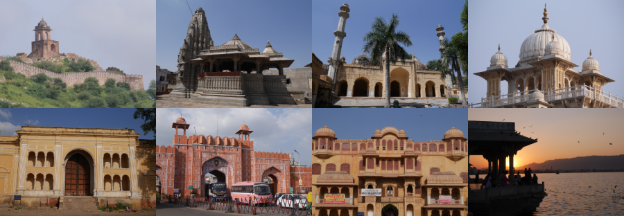
But I can upload them on my own website. So here they are, Internet! These are some of the state-protected monuments of Jaipur that WLM 2016 missed. All of them are in the old capital Amber.

Panchmukhi Mahadev Temple backside

Picture 1 of 8

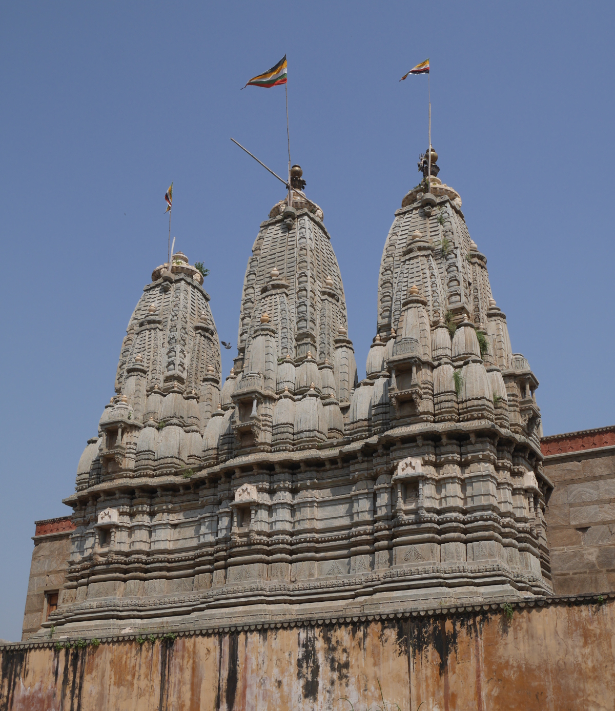
Backside of Panchmukhi Mahadev Temple. This is one of two temples in the town with three shikharas (spires) like this.

Page 1 of 3

Powered by WordPress & Theme by Anders Norén