WillyLogan.com

Technology, History, and Place

Tag: urban space (Page 1 of 3)

10317-montreal-skyline-habitat-67_1996px

The ex-churches of Quebec

Quebec was colonized in the 17th century by France, a country that remained largely Catholic even as England, northern Germany, and other parts of Europe were turning Protestant. Like the mother-country, Quebec became Catholic. Protestants were not even allowed to settle there. Only after the British takeover of Canada in the mid-18th century was Protestantism even tolerated in Quebec.

In much more recent times, Catholic Church membership and attendance have dropped off sharply in Quebec, and many congregations have had to close their doors. The availability of deconsecrated church buildings has given rise to some intriguing examples of adaptive reuse. On a recent visit to Quebec, I saw one church that had been converted into a restaurant and another that was a fitness center. Neither use really makes sense to me, because they do not take advantage of the single large, enclosed space that is a hallmark of churches.

Decline in church membership is only one reason why churches might be converted to other uses or torn down. Another is urban redevelopment, which is carried out with particular ferocity on the land-hungry island of Montreal. Churches—along with many other buildings of historic value—disappear and are replaced by new construction.

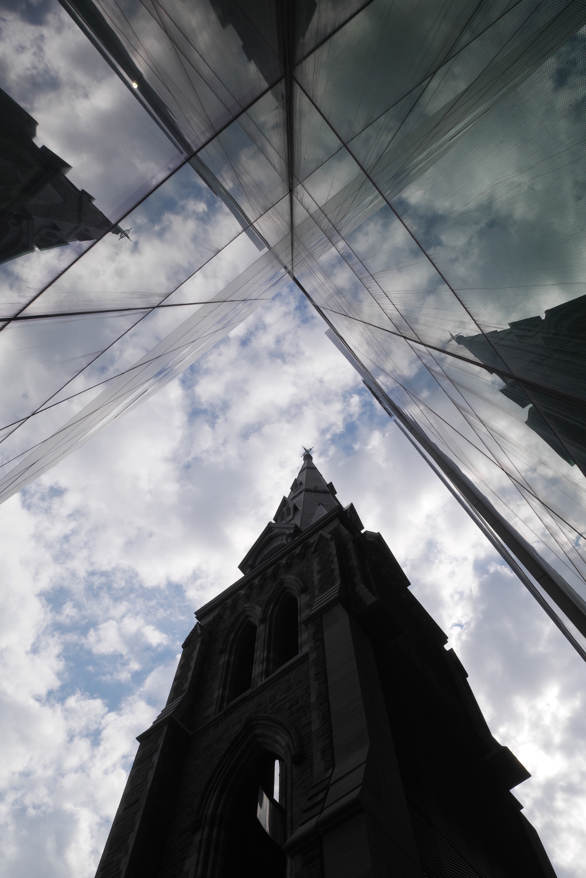
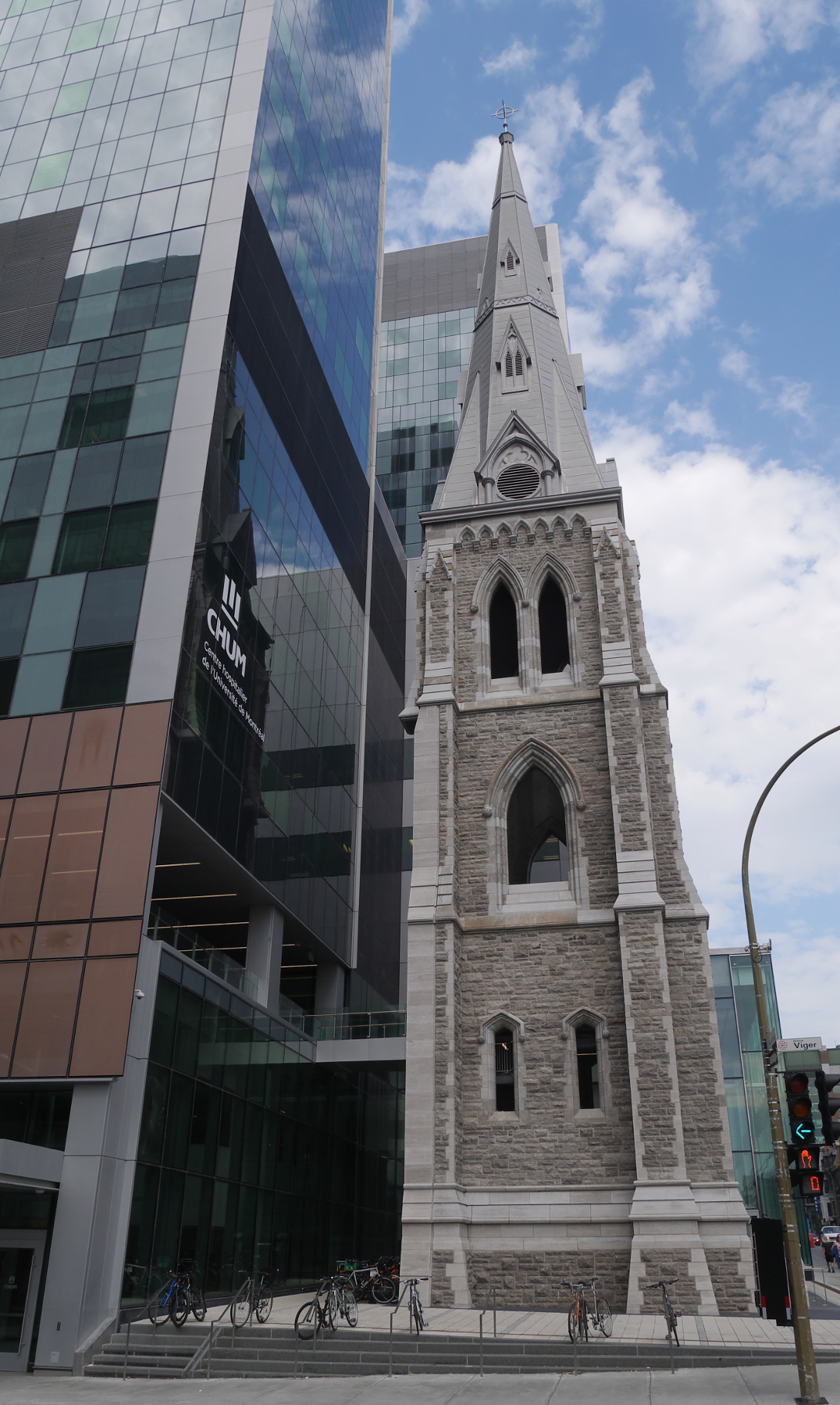
But they don’t all disappear without a trace. On the corner of Viger and St. Denis streets, there stands a lonely church tower without a church. This is the tower of Trinity Anglican Church, built in 1865 and demolished in 2011 to make room for a giant new hospital, University of Montreal Health Centre. The tower was rebuilt in 2016, using the original stones. Even as the city is redeveloped, this memento of the past has been retained.

The reconstructed church tower of Trinity Anglican Church, next to University of Montreal Health Centre.

The reconstructed church tower of Trinity Anglican Church, next to University of Montreal Health Centre.

The Gothic church tower has been integrated into the glassy facade of the hospital.

The Gothic church tower reflected in the glassy facade of the hospital.

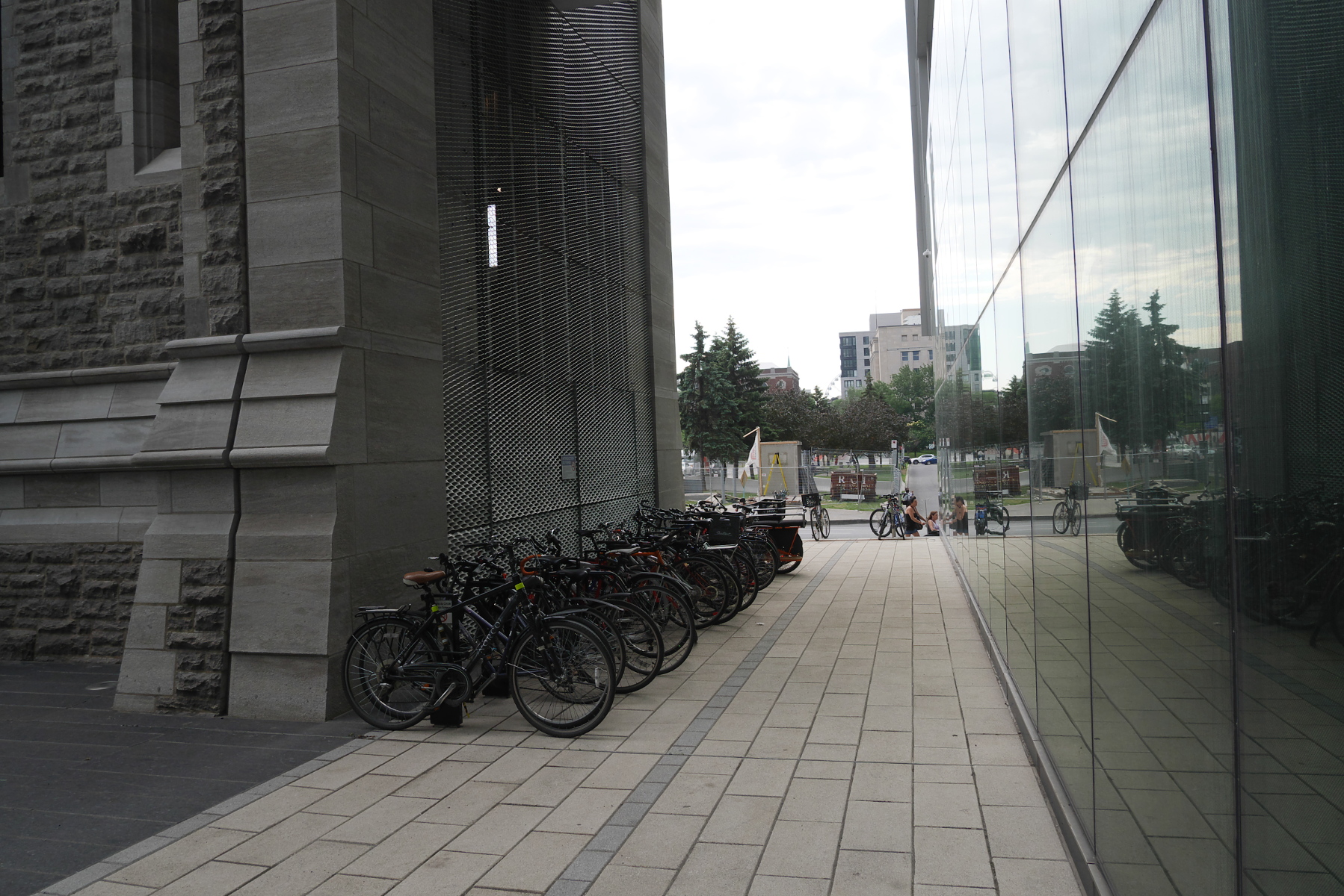
The backside of the tower is used for bicycle parking.

The backside of the tower is used for bicycle parking.

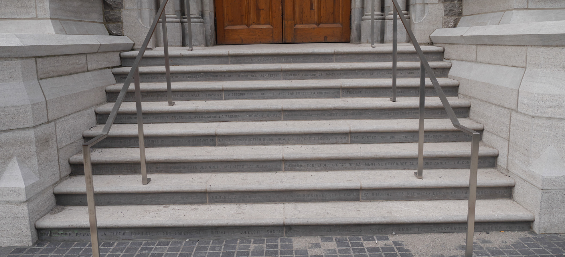
The story of Trinity Anglican Church is inscribed in the reconstructed steps below the doorway.

The story of Trinity Anglican Church (in French) is inscribed in the reconstructed steps below the doorway.

Vanishing Montreal blog has pictures of Trinity Anglican Church shortly before and during its demolition.

Brooklyn Bridges pan

Exploring Brooklyn’s battlefield

In 2014, I spent part of the summer in Washington, DC, researching for my dissertation at the National Archives and Library of Congress. On weekends and some afternoons, I explored the city and surrounding region, and I even made longer trips to Pennsylvania and New York. As I traveled around, I kept running across sites or artifacts associated with the American Revolutionary War. The more I saw and read about the Revolution, the more I became aware of how little I knew about that part of history.

I made up my mind to read The Glorious Cause, by Robert Middlekauff, the volume of the Oxford History of the United States about the Revolution. The book is long, so it took me a while (I had to take a lengthy break in the middle), but it was worth reading, because I learned much that I, as a historian of the twentieth century, had never before had occasion to learn. (Since my fateful summer of 2014, interest in the Revolutionary War has gone mainstream, thanks to Lin-Manuel Miranda and Hamilton.)

While reading The Glorious Cause, I was particularly fascinated by Middlekauff’s narrative of the Battle of Long Island, also known as the Battle of Brooklyn—an engagement I had never heard of before. The Battle of Brooklyn (August 26-30, 1776) was the first major military engagement of the American Revolution after the adoption of the Declaration of Independence two months earlier. British troops, under the command of General William Howe, landed on Long Island and attacked the Americans under George Washington. (These events are covered in the Hamilton song “Right-hand Man.”) The American forces were protected behind the hills known as the Heights. The passes nearest the American positions in Brooklyn (then a village independent of Manhattan) were well defended, but the British circumvented the defenses by taking the lightly-defended Jamaica Pass to the east. A contingent of Marylanders died holding the main body of the British troops off at the Vechte farm, but most of the rest of Washington’s army escaped across the East River to Manhattan, surviving to fight another day.

In the 240 years since the battle, Brooklyn has grown to engulf the farmlands and woodlands where British and Continentals clashed. Scattered around the borough are sites associated with the battle, some marked with plaques, others not (but all listed in detail in this comprehensive guide). In addition to gentrified brownstones, hipster lofts, and forbidding project housing, Brooklyn has its own Revolutionary War battlefield. Brooklyn has it all.

In March this year, I spent a day exploring Brooklyn, looking for sites that had to do with the battle or the Revolution in general. I found two sites particularly interesting.

The first was Prospect Park, site of a pass where American troops were routed by Hessian mercenaries fighting on the British side. The park, designed by Frederick Law Olmstead (whose other credits include Central Park in Manhattan and the US Capitol grounds) preserves part of the landscape of the battlefield, which has been lost under buildings and streets most everywhere else in the borough.

On a hillside in the park stands a monument to “Maryland’s Four Hundred,” who fell holding back the British (or “saved the American army,” in the exaggerated wording of the monument). The mention of the number of Marylanders is a not-so-subtle reference to the Three Hundred Spartans, who held the Persian army off at the Battle of Thermopylae in 480 BC, while the armies of other Greek city-states escaped to regroup and ultimately defeat the Persians. The placement of the monument to 400 Marylanders in the park, near the battle pass, is another reference to Thermopylae, because the Spartans died defending a pass. But despite the monument’s claim that the Marylanders performed their great deed “on this battlefield,” they did not fight in a pass; they fought on a farm, more than a mile from the monument.
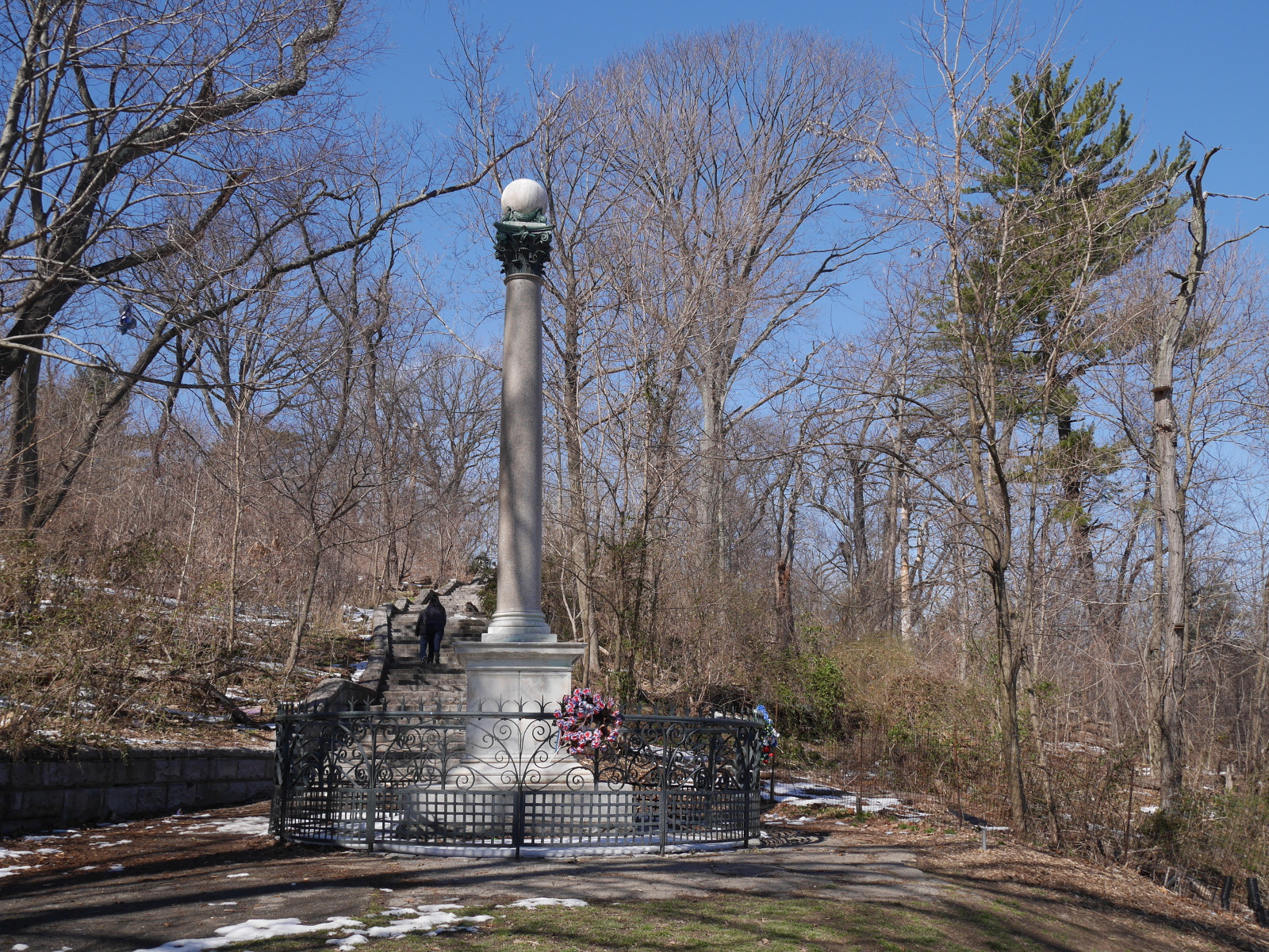
Memorial to "Maryland's Four Hundred" in Prospect Park, Brooklyn.

Memorial to “Maryland’s Four Hundred” in Prospect Park, Brooklyn.
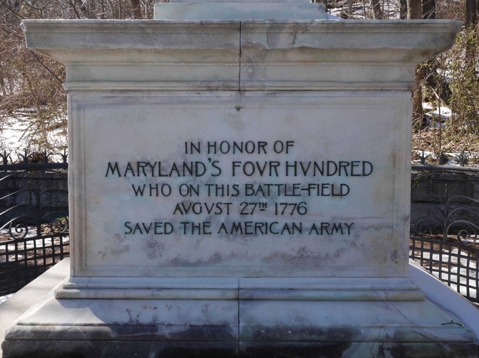
Misleading inscription on the memorial to "Maryland's Four Hundred."

Misleading inscription on the memorial to “Maryland’s Four Hundred.”

The site of that farm is the other especially interesting site related to the Battle of Brooklyn. The old farm is also a park—not a grand park like Prospect, but a small municipal park with a playground and athletic fields. In the middle of the park stands the Old Stone House. Originally built in 1699, the Vechte Farmhouse went to ruin and was demolished around 1900, but then in the 1930s the stones were dug up and the house reconstructed from drawings. The ground floor contains a small, free museum about the battle and its context.
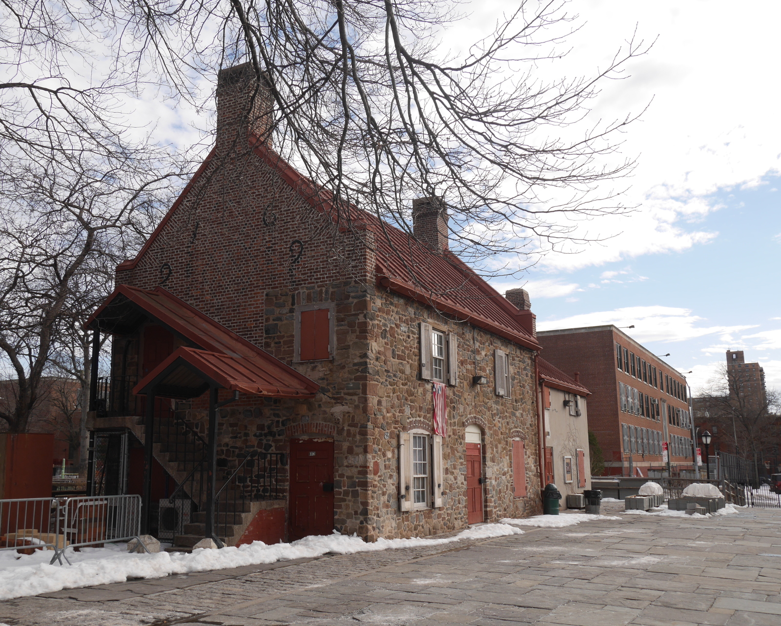
The reconstructed Vechte farmhouse, Washington Park, Brooklyn.

The reconstructed Vechte farmhouse, Washington Park, Brooklyn.

The Old Stone House isn’t exactly the Vechte Farmhouse that stood there during the battle. It is a twentieth-century building made of seventeenth-century parts. But that doesn’t matter to me. What does matter is that there is plenty of continuity with the past, there and at other sites associated with the Battle of Brooklyn. There may be no national park for the battlefield, as there are for Saratoga and Yorktown. Instead, remnants of the eighteenth-century battle and its memorialization live on in twenty-first-century New York City.
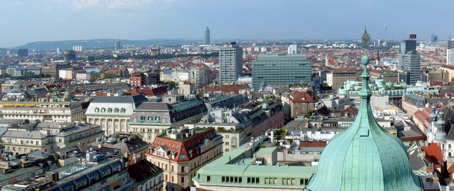
View of Vienna from Stephansdom.

From fortress to boulevard

The most picturesque part of Vienna, a city known for its beauty, is Ringstrasse, the Ring Road that encircles the oldest part of the city. The broad, attractive road wraps around three sides of the historic city center, with the Danube River closing the loop to the north. Many of the city’s most important cultural and civic buildings line Ringstrasse, including the opera house, Rathaus (town hall), the Austrian parliament, and an assortment of museums and libraries.

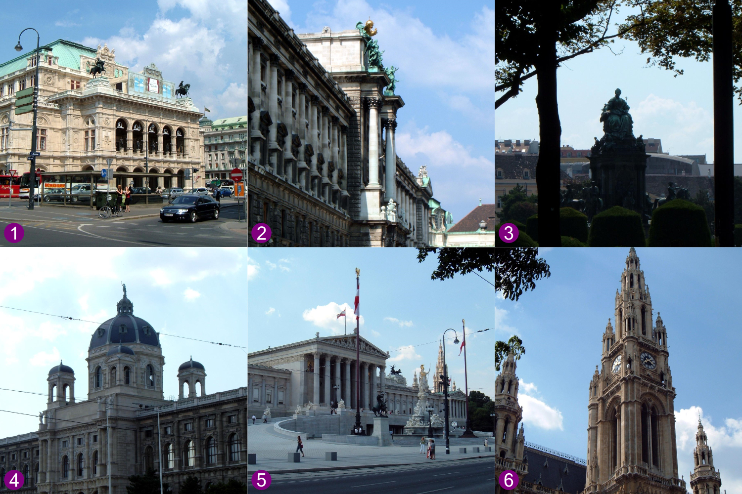
Monuments on Ringstrasse in Vienna: 1) Staatsoper (1869); 2) Hofburg (1881-1913); 3) Maria-Theresien-Platz (1889); 4) Naturhistorisches Museum (1889); 5) Parlement (1883); 6) Rathaus (1883).

Monuments on Ringstrasse in Vienna: 1) Staatsoper (1869); 2) Hofburg (1881-1913); 3) Maria-Theresien-Platz (1889); 4) Naturhistorisches Museum (1889); 5) Parlement (1883); 6) Rathaus (1883).

Ringstrasse is a legacy of the Austrian Empire, when Vienna was the capital of a multi-ethnic, polyglot empire eight times the size of Austria today. Emperor Franz Josef, who reigned from 1848 to 1916, spearheaded the development and beautification of his capital city early in his reign. In 1857, he authorized the most dramatic change to the city: demolishing the old defensive works to make room for Ringstrasse and the buildings alongside it.

But what were these defensive works that made way for Ringstrasse? When I first learned about Ringstrasse on a wonderful but brief visit to Vienna eleven years ago, I had the impression that they were medieval walls, made of stone. This didn’t really make sense to me, though, because medieval walls, such as those that still stand in Rothenburg, do not take up much space—not nearly as much as Ringstrasse and the neighboring buildings. In fact, Vienna had been defended by early-modern fortifications. The city’s medieval walls had been torn down and rebuilt in the sixteenth and seventeenth centuries to defend against the Ottoman Turks. A large open area in front of the defensive works, known as the glacis, was kept clear to offer a clear field of fire. The buildings of Ringstrasse were constructed on the land that had been kept open for the glacis.

Early-modern defensive works had a low profile and a large footprint. Consisting mostly of large earthen berms, the fortifications were designed to defend against the offensive weapon of the age: the smooth-bore cannon. The earthworks absorbed the impact of cannonballs, which could easily shatter stone defenses. These early-modern defenses were in vogue until the introduction of rifled-bore artillery, which made its debut in the American Civil War.

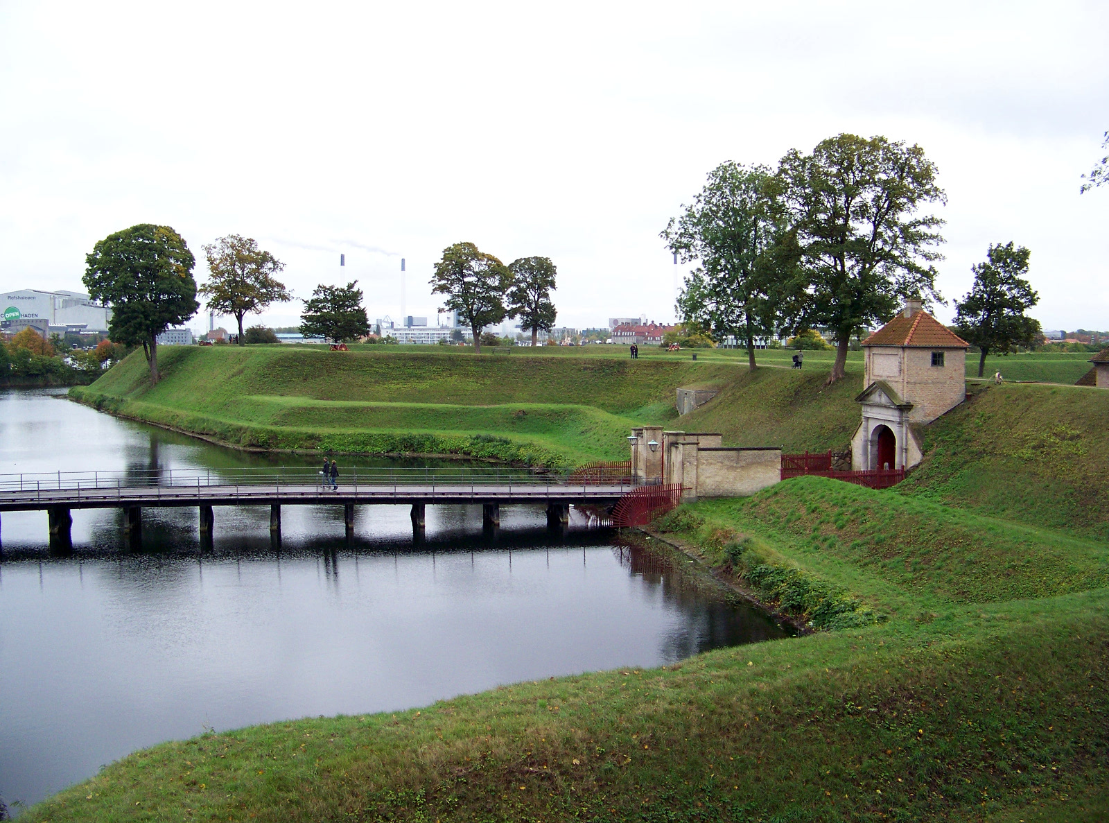
Kastellet, an early-modern star fort in Copenhagen.

Kastellet, an early-modern star fort in Copenhagen.

Many (but not all) early modern-fortifications had triangular projections at regular intervals along the berms or walls—the origin of the nickname “star fort.” The projections allowed soldiers standing on them to shoot at attackers from either side, trapping them in enfilading fire. An 1858 map of Vienna, drawn before the old defenses were demolished, shows triangular projections at regular intervals along the wall.

Another city that once had early-modern fortifications, but does no longer, is Frankfurt. The German city’s approach to using the land freed up by the demolition of the defenses was different from Vienna’s. The land once occupied by Frankfurt’s defenses is now taken up by a park that wraps around the historic city center. Even some of the triangular star-fort projections have been converted into parkland. They are visible on modern maps of the city—a telltale sign that this park was once an early-modern fortification.

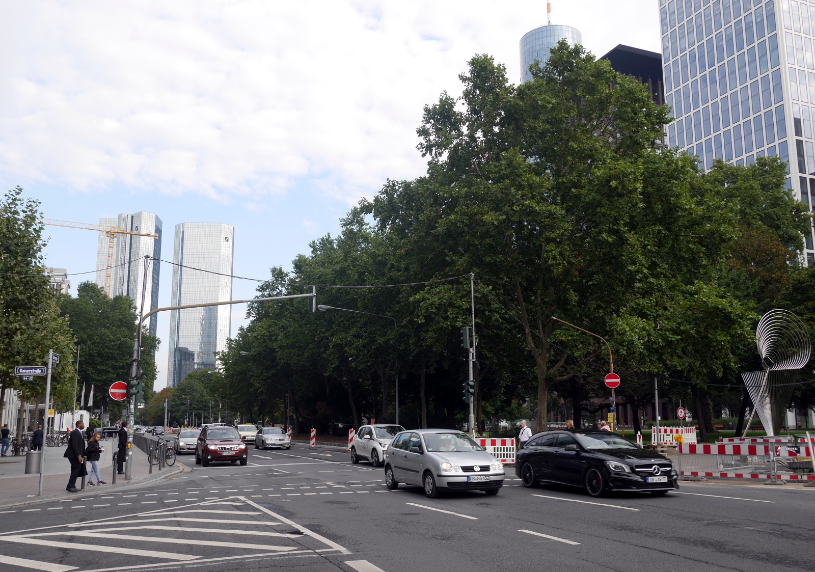
Gallusanlage, part of the greenway on the site of the former fortifications of Frankfurt am Main.

Gallusanlage, part of the greenway on the site of the former fortifications of Frankfurt am Main.

Links

Page 1 of 3

Powered by WordPress & Theme by Anders Norén